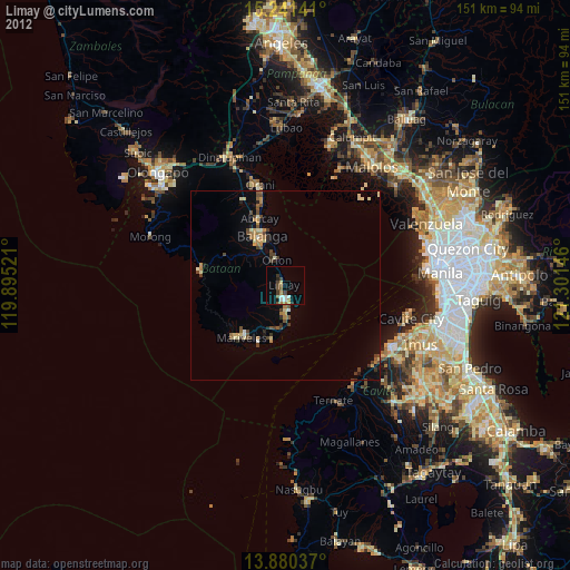
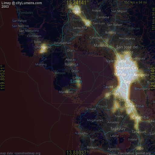
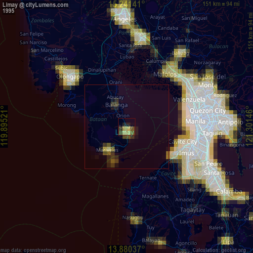
Limay night lights from space
Night Light of Limay (Central Luzon) from space (Philippines) Src. Average luminocity for 10x10km area is 23.4805% and for 50x50km: 4.7751%.

Analysis of Limay night lights 2016
Square area 10x10 km:
 4.11%
4.11%90-99
1.95%80-89
0.43%70-79
0.87%60-69
6.49%50-59
2.6%40-49
8.44%30-39
3.9%20-29
2.38%10-19
20.35%0-9
48.48%Square area 50x50 km:
0.24%90-99
0.19%80-89
0.16%70-79
1.03%60-69
1%50-59
0.69%40-49
0.98%30-39
1.07%20-29
0.57%10-19
4.05%0-9
90.01%Clear (daylight) street map image can be seen on geolist.org.
Map coordinates:
15° 14' 29.1" North, 119° 53' 42.8" East
14° 33' 43" North, 120° 35' 54" East
13° 52' 49.3" North, 121° 18' 5.3" East
Some cities around Limay sort by population:
• Mariveles
18.7 km =11.6 mi,  220°
220°
• Balanga
14.4 km =8.9 mi,  332°
332°
• Orion
6.8 km =4.2 mi,  344°
344°
• Orani
27.3 km =17 mi,  346°
346°
• Abucay
20.3 km =12.6 mi, 339°
• Samal
23.6 km =14.7 mi, 345°
• Pilar
11.5 km =7.1 mi, 341°
• Cabcaben
12 km =7.5 mi,  183°
183°
1706361 (p: 52,824)
Sources (retrieved 2019-11-25):
» NASA, Earths city lights 1995
» NASA city lights 2003
» Earth at Night: Flat Maps 2012, 2016