Janiuay night lights from space
Night Light of Janiuay (Western Visayas) from space (Philippines) Src. Average luminocity for 10x10km area is 1.2576% and for 50x50km: 3.0252%.
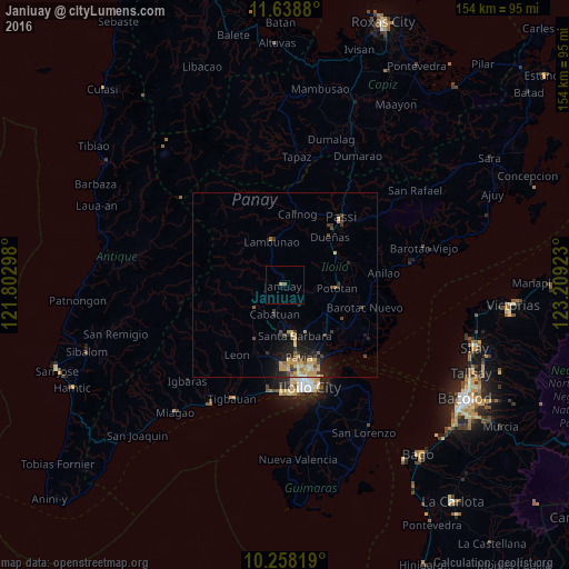
Analysis of Janiuay night lights 2016
Square area 10x10 km:
 0%
0%90-99
0%80-89
0%70-79
0.87%60-69
0%50-59
0.87%40-49
0%30-39
0%20-29
0%10-19
0%0-9
98.27%Square area 50x50 km:
0.03%90-99
0.03%80-89
0.84%70-79
0.86%60-69
0.37%50-59
0.23%40-49
0.62%30-39
0.55%20-29
0.88%10-19
2.25%0-9
93.34%Clear (daylight) street map image can be seen on geolist.org.
Map coordinates:
11° 38' 19.7" North, 121° 48' 10.7" East
10° 56' 57.5" North, 122° 30' 22" East
10° 15' 29.5" North, 123° 12' 33.2" East
Some cities around Janiuay sort by population:
• Pototan
14.1 km =8.8 mi,  92°
92°
• Santa Barbara
14.4 km =8.9 mi,  167°
167°
• San Miguel
19.3 km =12 mi,  193°
193°
• Alimodian
16.4 km =10.2 mi,  209°
209°
• Dingle
18.9 km =11.7 mi,  72°
72°
• Cabatuan
8.1 km =5 mi,  195°
195°
• Lambunao
12.3 km =7.6 mi,  344°
344°
• Tumcon Ilawod
17.9 km =11.1 mi,  101°
101°
1710286 (p: 12,896)
Sources (retrieved 2019-11-25):
» Earth at Night: Flat Maps 2012, 2016