Alimodian night lights from space
Night Light of Alimodian (Western Visayas) from space (Philippines) Src. Average luminocity for 10x10km area is 0.9567% and for 50x50km: 5.1042%.
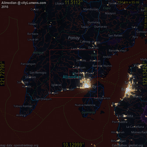
Analysis of Alimodian night lights 2016
Square area 10x10 km:
 0%
0%90-99
0%80-89
0%70-79
0%60-69
0%50-59
0%40-49
0.87%30-39
0%20-29
0.87%10-19
0%0-9
98.27%Square area 50x50 km:
0.37%90-99
0.45%80-89
1.28%70-79
1.13%60-69
0.55%50-59
0.31%40-49
0.76%30-39
0.6%20-29
1.47%10-19
3.94%0-9
89.12%Clear (daylight) street map image can be seen on geolist.org.
Map coordinates:
11° 30' 40.3" North, 121° 43' 40.8" East
10° 49' 17" North, 122° 25' 52" East
10° 7' 48" North, 123° 8' 3.3" East
Some cities around Alimodian sort by population:
• Oton
15 km =9.3 mi,  161°
161°
• Trapiche
15.3 km =9.5 mi,  179°
179°
• Santa Barbara
11.3 km =7 mi,  89°
89°
• San Miguel
5.9 km =3.7 mi,  140°
140°
• Cabatuan
8.8 km =5.5 mi,  42°
42°
• Pavia
13.5 km =8.4 mi,  111°
111°
• Ungca
15.2 km =9.4 mi,  121°
121°
• Leon
6.4 km =4 mi,  225°
225°
1731441 (p: 7,302)
Sources (retrieved 2019-11-25):
» Earth at Night: Flat Maps 2012, 2016