Laurel night lights from space
Night Light of Laurel (Calabarzon) from space (Philippines) Src. Average luminocity for 10x10km area is 12.7186% and for 50x50km: 16.2417%.
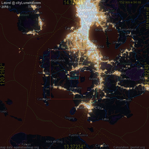
Analysis of Laurel night lights 2016
Square area 10x10 km:
 0%
0%90-99
0.43%80-89
0.43%70-79
2.6%60-69
3.03%50-59
1.95%40-49
2.38%30-39
1.52%20-29
1.08%10-19
22.73%0-9
63.85%Square area 50x50 km:
1.03%90-99
1.49%80-89
1.53%70-79
5.05%60-69
2.89%50-59
1.72%40-49
3.32%30-39
2.52%20-29
3.75%10-19
10.06%0-9
66.65%Clear (daylight) street map image can be seen on geolist.org.
Map coordinates:
14° 44' 11.3" North, 120° 12' 58.3" East
14° 3' 19.5" North, 120° 55' 9.6" East
13° 22' 20.4" North, 121° 37' 20.8" East
Some cities around Laurel sort by population:
• Tagaytay
4.7 km =2.9 mi,  19°
19°
• Patuto
8.5 km =5.3 mi,  36°
36°
• Talisay
11.8 km =7.3 mi,  69°
69°
• Mendez-Nuñez
8.3 km =5.2 mi,  349°
349°
• Amadeo
12.8 km =8 mi,  2°
2°
• Alfonso
11.8 km =7.3 mi,  323°
323°
• Subic
12.1 km =7.5 mi,  169°
169°
• Malabag
12.2 km =7.6 mi, 24°
1707045 (p: 9,720)
Sources (retrieved 2019-11-25):
» Earth at Night: Flat Maps 2012, 2016