Aga night lights from space
Night Light of Aga (Calabarzon) from space (Philippines) Src. Average luminocity for 10x10km area is 2.3636% and for 50x50km: 10.6847%.
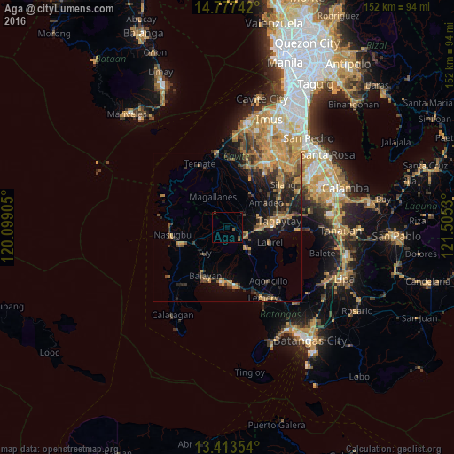
Analysis of Aga night lights 2016
Square area 10x10 km:
 0%
0%90-99
0%80-89
0%70-79
0%60-69
0.87%50-59
0.87%40-49
1.3%30-39
0%20-29
0.22%10-19
0%0-9
96.75%Square area 50x50 km:
0.17%90-99
0.23%80-89
0.7%70-79
3.7%60-69
2.75%50-59
1.59%40-49
2.63%30-39
1.91%20-29
2.45%10-19
6.72%0-9
77.16%Clear (daylight) street map image can be seen on geolist.org.
Map coordinates:
14° 46' 38.7" North, 120° 5' 56.6" East
14° 5' 47.4" North, 120° 48' 7.8" East
13° 24' 48.7" North, 121° 30' 19.1" East
Some cities around Aga sort by population:
• Tagaytay
14.2 km =8.8 mi,  90°
90°
• Indang
13.6 km =8.5 mi,  36°
36°
• Mendez-Nuñez
11.7 km =7.3 mi,  72°
72°
• General Emilio Aguinaldo
9.8 km =6.1 mi,  355°
355°
• Laurel
13.4 km =8.3 mi,  109°
109°
• Alfonso
7.4 km =4.6 mi,  48°
48°
• Tuy
11.7 km =7.3 mi,  221°
221°
• Putol
14.1 km =8.8 mi,  214°
214°
1732205 (p: 5,218)
Sources (retrieved 2019-11-25):
» Earth at Night: Flat Maps 2012, 2016