Tuy night lights from space
Night Light of Tuy (Calabarzon) from space (Philippines) Src. Average luminocity for 10x10km area is 1.8918% and for 50x50km: 4.5835%.
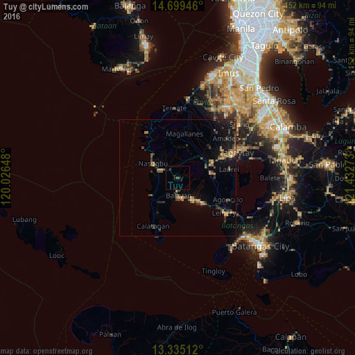
Analysis of Tuy night lights 2016
Square area 10x10 km:
100  0%
0%
90-99 0%
80-89 0%
70-79 0%
60-69 0%
50-59 0%
40-49 1.3%
30-39 1.3%
20-29 0%
10-19 0%
0-9 97.4%
0%90-99
0%80-89
0%70-79
0%60-69
0%50-59
0%40-49
1.3%30-39
1.3%20-29
0%10-19
0%0-9
97.4%Square area 50x50 km:
100 0.07%
90-99 0.07%
80-89 0.12%
70-79 1.17%
60-69 0.95%
50-59 0.73%
40-49 1.2%
30-39 1.03%
20-29 0.96%
10-19 3.44%
0-9 90.27%
0.07%90-99
0.07%80-89
0.12%70-79
1.17%60-69
0.95%50-59
0.73%40-49
1.2%30-39
1.03%20-29
0.96%10-19
3.44%0-9
90.27%Clear (daylight) street map image can be seen on geolist.org.
Map coordinates:
14° 41' 58.1" North, 120° 1' 35.3" East
14° 1' 5.9" North, 120° 43' 46.6" East
13° 20' 6.4" North, 121° 25' 57.8" East
Some cities around Tuy sort by population:
• Nasugbu
11.9 km =7.4 mi,  297°
297°
• Balayan
9 km =5.6 mi,  178°
178°
• Calaca
13.1 km =8.1 mi,  136°
136°
• Lian
8.8 km =5.5 mi,  281°
281°
• Lumbangan
7.8 km =4.8 mi, 299°
• Binubusan
11.5 km =7.1 mi,  241°
241°
• Putol
2.9 km =1.8 mi, 184°
• Aga
11.7 km =7.3 mi,  41°
41°
1680554 (p: 8,603)
Sources (retrieved 2019-11-25):
» Earth at Night: Flat Maps 2012, 2016