Calabugao night lights from space
Night Light of Calabugao (Northern Mindanao) from space (Philippines) Src. Average luminocity for 10x10km area is 0.6798% and for 50x50km: 0.2445%.
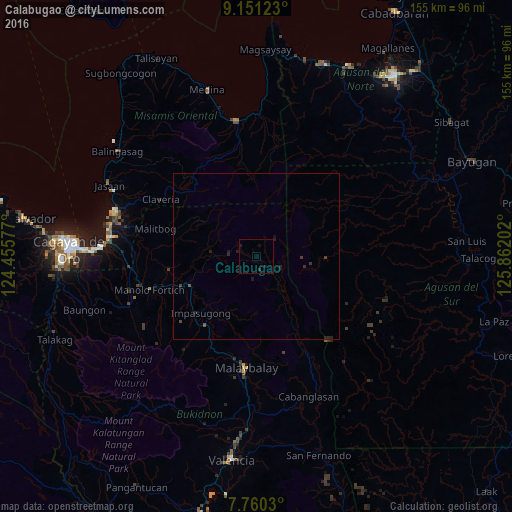
Analysis of Calabugao night lights 2016
Square area 10x10 km:
 0%
0%90-99
0%80-89
0%70-79
0%60-69
0%50-59
0%40-49
0%30-39
0%20-29
0.83%10-19
2.48%0-9
96.69%Square area 50x50 km:
0%90-99
0%80-89
0%70-79
0%60-69
0%50-59
0.03%40-49
0.1%30-39
0.13%20-29
0.26%10-19
0.29%0-9
99.18%Clear (daylight) street map image can be seen on geolist.org.
Map coordinates:
9° 9' 4.4" North, 124° 27' 20.8" East
8° 27' 23" North, 125° 9' 32" East
7° 45' 37.1" North, 125° 51' 43.3" East
Some cities around Calabugao sort by population:
• Malaybalay
33.4 km =20.8 mi,  185°
185°
• Manolo Fortich
33.8 km =21 mi,  253°
253°
• Casisang
35.6 km =22.1 mi, 186°
• Kisolon
24.5 km =15.2 mi,  234°
234°
• Claveria
33.7 km =20.9 mi,  300°
300°
• Sumpong
32.9 km =20.4 mi, 187°
• San Luis
17.7 km =11 mi,  279°
279°
• Sumilao
30.1 km =18.7 mi, 231°
1720758 (p: 5,982)
Sources (retrieved 2019-11-25):
» Earth at Night: Flat Maps 2012, 2016