Manolo Fortich night lights from space
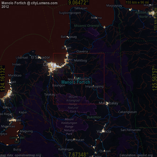
Night Light of Manolo Fortich (Northern Mindanao) from space (Philippines) Src. Average luminocity for 10x10km area is 2.0083% and for 50x50km: 3.6119%.
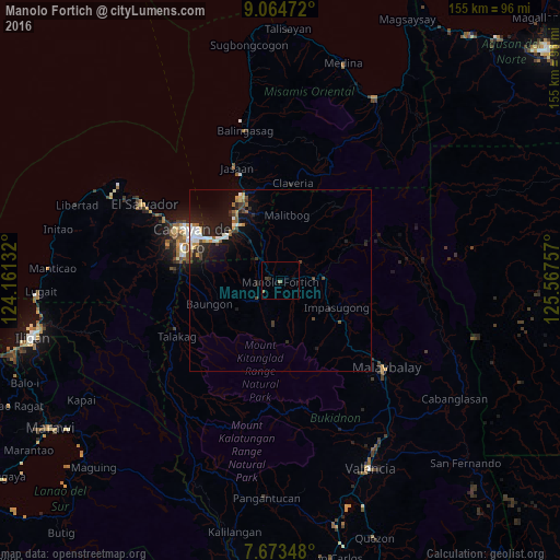
Analysis of Manolo Fortich night lights 2016
Square area 10x10 km:
 0%
0%90-99
0%80-89
0%70-79
0%60-69
1.03%50-59
0.62%40-49
0.41%30-39
0.83%20-29
0.41%10-19
0.83%0-9
95.87%Square area 50x50 km:
0.52%90-99
0.62%80-89
0.3%70-79
0.31%60-69
0.36%50-59
0.37%40-49
0.52%30-39
0.5%20-29
1.25%10-19
3.54%0-9
91.71%Clear (daylight) street map image can be seen on geolist.org.
Map coordinates:
9° 3' 53" North, 124° 9' 40.8" East
8° 22' 11" North, 124° 51' 52" East
7° 40' 24.5" North, 125° 34' 3.3" East
Some cities around Manolo Fortich sort by population:
• Bugo
19.3 km =12 mi,  323°
323°
• Agusan
19.4 km =12.1 mi,  313°
313°
• Damilag
6 km =3.7 mi,  253°
253°
• Kisolon
13.1 km =8.1 mi,  109°
109°
• Santa Ana
18.6 km =11.6 mi,  331°
331°
• Libona
14.6 km =9.1 mi,  256°
256°
• Sumilao
12.8 km =8 mi,  135°
135°
• Alae
8.3 km =5.2 mi, 316°
1701537 (p: 27,064)
Sources (retrieved 2019-11-25):
» Earth at Night: Flat Maps 2012, 2016