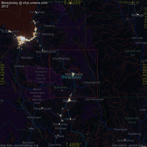
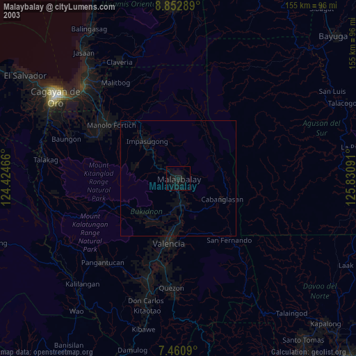
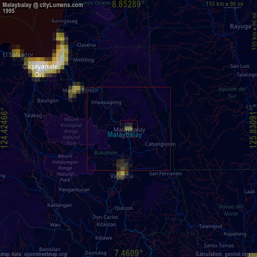
Malaybalay night lights from space
Night Light of Malaybalay (Northern Mindanao) from space (Philippines) Src. Average luminocity for 10x10km area is 5.3471% and for 50x50km: 0.5544%.
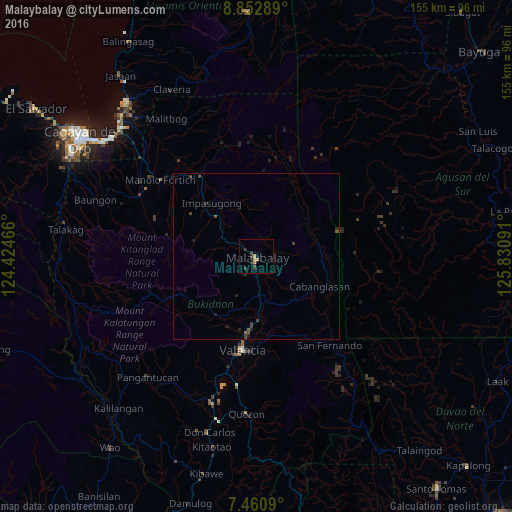
Analysis of Malaybalay night lights 2016
Square area 10x10 km:
 0%
0%90-99
0%80-89
0.21%70-79
3.1%60-69
0%50-59
0%40-49
1.45%30-39
3.1%20-29
1.24%10-19
0.83%0-9
90.08%Square area 50x50 km:
0%90-99
0%80-89
0.01%70-79
0.13%60-69
0%50-59
0.13%40-49
0.24%30-39
0.28%20-29
0.23%10-19
0.19%0-9
98.79%Clear (daylight) street map image can be seen on geolist.org.
Map coordinates:
8° 51' 10.4" North, 124° 25' 28.8" East
8° 9' 27" North, 125° 7' 40" East
7° 27' 39.2" North, 125° 49' 51.3" East
Some cities around Malaybalay sort by population:
• Casisang
2.2 km =1.4 mi,  188°
188°
• Sumpong
1.2 km =0.7 mi,  301°
301°
• Managok
15.8 km =9.8 mi,  154°
154°
• Linabo
11.9 km =7.4 mi,  165°
165°
• Aglayan
11.4 km =7.1 mi,  176°
176°
• Cabanglasan
22.3 km =13.9 mi,  100°
100°
• Mailag
20.8 km =12.9 mi, 177°
• Lantapan
20.9 km =13 mi,  211°
211°
1702934 (p: 61,524)
Sources (retrieved 2019-11-25):
» NASA, Earths city lights 1995
» NASA city lights 2003
» Earth at Night: Flat Maps 2012, 2016