Bone South night lights from space
Night Light of Bone South (Cagayan Valley) from space (Philippines) Src. Average luminocity for 10x10km area is 0.0165% and for 50x50km: 0.1056%.
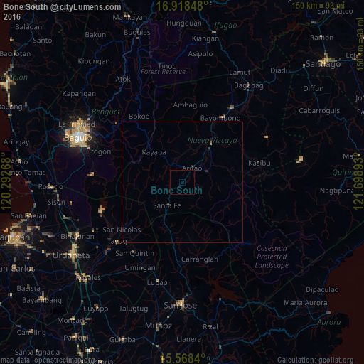
Analysis of Bone South night lights 2016
Square area 10x10 km:
 0%
0%90-99
0%80-89
0%70-79
0%60-69
0%50-59
0%40-49
0%30-39
0%20-29
0%10-19
0%0-9
100%Square area 50x50 km:
0%90-99
0%80-89
0%70-79
0%60-69
0.03%50-59
0%40-49
0.06%30-39
0.04%20-29
0.07%10-19
0.07%0-9
99.74%Clear (daylight) street map image can be seen on geolist.org.
Map coordinates:
16° 55' 6.5" North, 120° 17' 33.6" East
16° 14' 40.6" North, 120° 59' 44.9" East
15° 34' 6.2" North, 121° 41' 56.1" East
Some cities around Bone South sort by population:
• Bayombong
31 km =19.3 mi,  31°
31°
• Solano
36.4 km =22.6 mi, 32°
• Baggabag B
35.7 km =22.2 mi,  35°
35°
• Bambang
19.7 km =12.2 mi, 36°
• Tayug
36.2 km =22.5 mi,  228°
228°
• Carranglan
32.3 km =20.1 mi,  166°
166°
• Aritao
7.2 km =4.5 mi, 34°
• Natividad
30.6 km =19 mi,  223°
223°
1724128 (p: 6,573)
Sources (retrieved 2019-11-25):
» Earth at Night: Flat Maps 2012, 2016