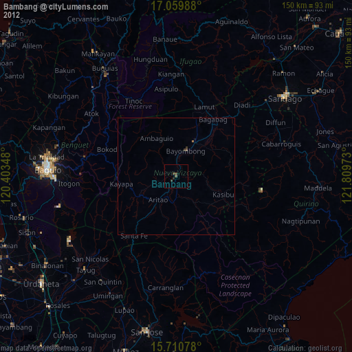
Bambang night lights from space
Night Light of Bambang (Cagayan Valley) from space (Philippines) Src. Average luminocity for 10x10km area is 1.6116% and for 50x50km: 0.3512%.
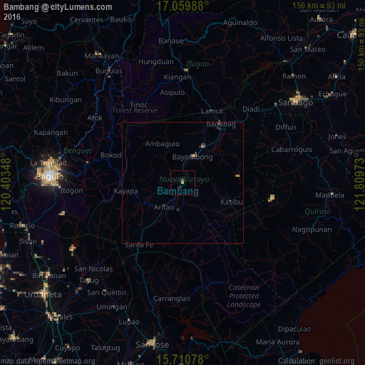
Analysis of Bambang night lights 2016
Square area 10x10 km:
 0%
0%90-99
0%80-89
0%70-79
0%60-69
0.83%50-59
0%40-49
0.83%30-39
0.83%20-29
0%10-19
0.83%0-9
96.69%Square area 50x50 km:
0%90-99
0%80-89
0.01%70-79
0.09%60-69
0.07%50-59
0.01%40-49
0.21%30-39
0.16%20-29
0.12%10-19
0.13%0-9
99.21%Clear (daylight) street map image can be seen on geolist.org.
Map coordinates:
17° 3' 35.6" North, 120° 24' 12.5" East
16° 23' 11.4" North, 121° 6' 23.8" East
15° 42' 38.8" North, 121° 48' 35" East
Some cities around Bambang sort by population:
• Bayombong
11.5 km =7.1 mi,  23°
23°
• Solano
16.8 km =10.4 mi,  28°
28°
• Itogon
45.9 km =28.5 mi,  266°
266°
• Baggabag B
16 km =9.9 mi, 33°
• Aritao
12.5 km =7.8 mi,  217°
217°
• Lagawe
46 km =28.6 mi,  1°
1°
• Bone South
19.7 km =12.2 mi, 216°
• Quezon
21.2 km =13.2 mi,  53°
53°
1727663 (p: 22,831)
Sources (retrieved 2019-11-25):
» Earth at Night: Flat Maps 2012, 2016