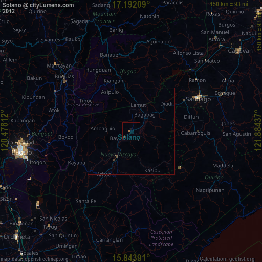
Solano night lights from space
Night Light of Solano (Cagayan Valley) from space (Philippines) Src. Average luminocity for 10x10km area is 3.9587% and for 50x50km: 0.3537%.
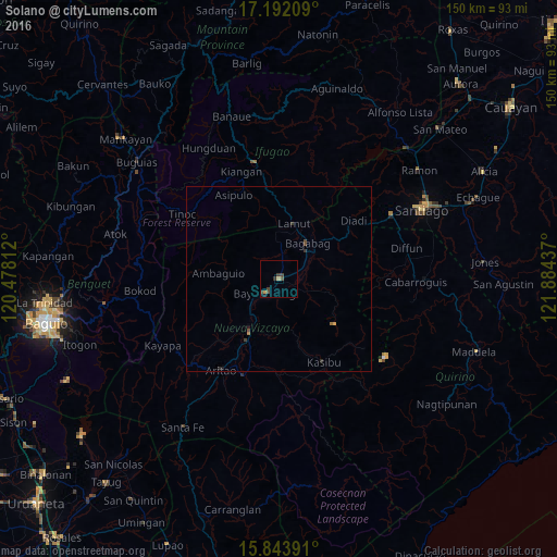
Analysis of Solano night lights 2016
Square area 10x10 km:
 0%
0%90-99
0%80-89
0%70-79
1.65%60-69
0%50-59
0.21%40-49
2.89%30-39
2.07%20-29
0.62%10-19
1.65%0-9
90.91%Square area 50x50 km:
0%90-99
0%80-89
0.01%70-79
0.09%60-69
0.07%50-59
0.01%40-49
0.21%30-39
0.18%20-29
0.09%10-19
0.13%0-9
99.21%Clear (daylight) street map image can be seen on geolist.org.
Map coordinates:
17° 11' 31.5" North, 120° 28' 41.2" East
16° 31' 9" North, 121° 10' 52.5" East
15° 50' 38.1" North, 121° 53' 3.7" East
Some cities around Solano sort by population:
• Bayombong
5.4 km =3.4 mi,  218°
218°
• Baggabag B
1.8 km =1.1 mi,  147°
147°
• Bambang
16.8 km =10.4 mi,  208°
208°
• Diadi
29.8 km =18.5 mi,  39°
39°
• Aritao
29.2 km =18.1 mi, 212°
• Cabarroguis
36.2 km =22.5 mi,  91°
91°
• Lagawe
31.9 km =19.8 mi,  348°
348°
• Quezon
9.4 km =5.8 mi,  103°
103°
1685875 (p: 36,222)
Sources (retrieved 2019-11-25):
» Earth at Night: Flat Maps 2012, 2016