Bayang night lights from space
Night Light of Bayang (Autonomous Region in Muslim Mindanao) from space (Philippines) Src. Average luminocity for 10x10km area is 2.7211% and for 50x50km: 0.9974%.
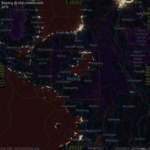
Analysis of Bayang night lights 2016
Square area 10x10 km:
 0%
0%90-99
0%80-89
0%70-79
2.89%60-69
0.41%50-59
0%40-49
0%30-39
0%20-29
0%10-19
0%0-9
96.69%Square area 50x50 km:
0%90-99
0.01%80-89
0.19%70-79
0.48%60-69
0.2%50-59
0.09%40-49
0.07%30-39
0.2%20-29
0.13%10-19
0%0-9
98.62%Clear (daylight) street map image can be seen on geolist.org.
Map coordinates:
8° 29' 19.8" North, 123° 29' 18.8" East
7° 47' 34" North, 124° 11' 30" East
7° 5' 44.1" North, 124° 53' 41.3" East
Some cities around Bayang sort by population:
• Mantampay
41.7 km =25.9 mi,  3°
3°
• Marawi City
25.5 km =15.8 mi,  23°
23°
• Boroon
43.4 km =27 mi,  357°
357°
• Bugasan
39.8 km =24.7 mi,  169°
169°
• Mamungan
36.2 km =22.5 mi, 4°
• Linamon
43.8 km =27.2 mi, 355°
• Butig
14.2 km =8.8 mi,  122°
122°
• Maria Cristina
41.5 km =25.8 mi, 1°
1725844 (p: 6,176)
Sources (retrieved 2019-11-25):
» Earth at Night: Flat Maps 2012, 2016