Mantampay night lights from space
Night Light of Mantampay (Northern Mindanao) from space (Philippines) Src. Average luminocity for 10x10km area is 13.7851% and for 50x50km: 2.64%.
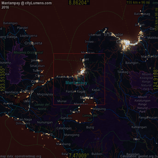

Analysis of Mantampay night lights 2016
Square area 10x10 km:
 0%
0%90-99
0%80-89
1.65%70-79
1.45%60-69
3.31%50-59
3.72%40-49
2.89%30-39
5.37%20-29
2.69%10-19
11.98%0-9
66.94%Square area 50x50 km:
0.23%90-99
0.21%80-89
0.34%70-79
0.37%60-69
0.43%50-59
0.47%40-49
0.28%30-39
0.51%20-29
0.37%10-19
2.01%0-9
94.79%Clear (daylight) street map image can be seen on geolist.org.
Map coordinates:
8° 51' 43.3" North, 123° 30' 48.8" East
8° 10' 0" North, 124° 13' 0" East
7° 28' 12.3" North, 124° 55' 11.3" East
Some cities around Mantampay sort by population:
• Iligan
7.5 km =4.7 mi,  23°
23°
• Boroon
4.7 km =2.9 mi,  292°
292°
• Mamungan
5.5 km =3.4 mi,  177°
177°
• Kauswagan
14.8 km =9.2 mi,  280°
280°
• Linamon
6.3 km =3.9 mi, 289°
• Maria Cristina
1.4 km =0.9 mi,  267°
267°
• Rogongon
14.8 km =9.2 mi,  60°
60°
• Libertad
9.4 km =5.8 mi,  11°
11°
1701472 (p: 265,032)
Sources (retrieved 2019-11-25):
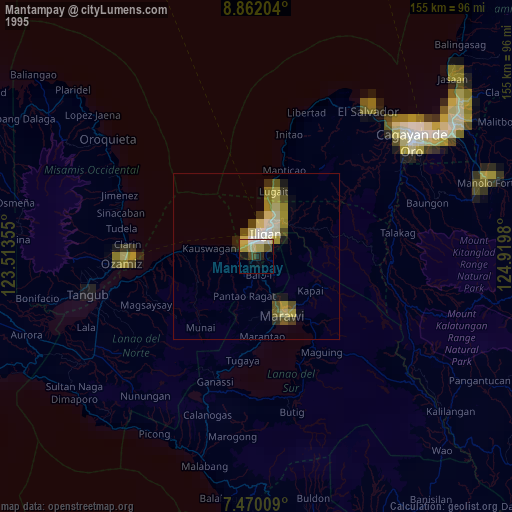
» NASA, Earths city lights 1995
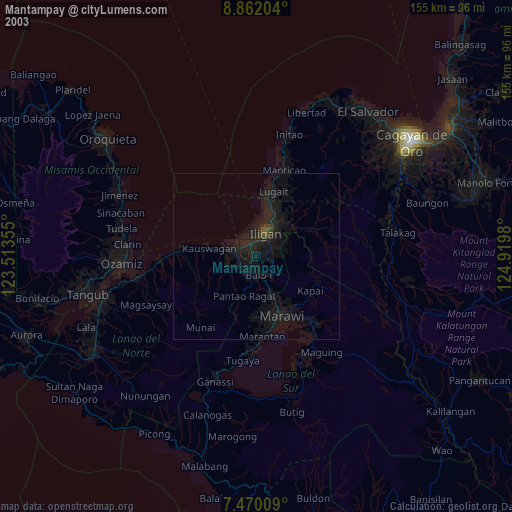
» NASA city lights 2003
» Earth at Night: Flat Maps 2012, 2016