San Isidro night lights from space
Night Light of San Isidro (Central Luzon) from space (Philippines) Src. Average luminocity for 10x10km area is 3.1136% and for 50x50km: 18.8552%.
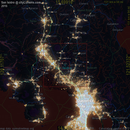
Analysis of San Isidro night lights 2016
Square area 10x10 km:
 0%
0%90-99
0%80-89
0%70-79
0%60-69
0.83%50-59
0%40-49
0%30-39
0%20-29
0.83%10-19
3.51%0-9
94.83%Square area 50x50 km:
0.49%90-99
0.69%80-89
1.22%70-79
4.84%60-69
5.59%50-59
3.02%40-49
4.84%30-39
4.78%20-29
6.47%10-19
11.33%0-9
56.74%Clear (daylight) street map image can be seen on geolist.org.
Map coordinates:
15° 41' 57" North, 120° 7' 1.5" East
15° 1' 16.2" North, 120° 49' 12.7" East
14° 20' 27.6" North, 121° 31' 24" East
Some cities around San Isidro sort by population:
• Apalit
9.3 km =5.8 mi,  215°
215°
• Candaba
8.3 km =5.2 mi,  4°
4°
• San Luis
4 km =2.5 mi,  301°
301°
• San Simon
4.9 km =3 mi,  240°
240°
• Bahay Pare
6.6 km =4.1 mi,  79°
79°
• Balucuc
7.6 km =4.7 mi,  184°
184°
• San Jose
4.2 km =2.6 mi,  288°
288°
• Santo Domingo
8.9 km =5.5 mi,  248°
248°
1689663 (p: 6,093)
Sources (retrieved 2019-11-25):
» Earth at Night: Flat Maps 2012, 2016