Antipolo night lights from space
Night Light of Antipolo (Western Visayas) from space (Philippines) Src. Average luminocity for 10x10km area is 2.1405% and for 50x50km: 1.3068%.
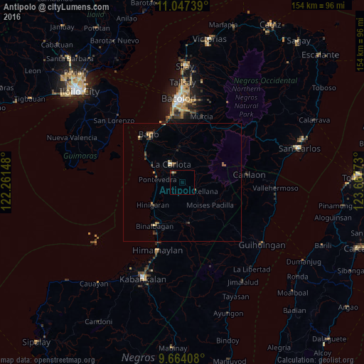
Analysis of Antipolo night lights 2016
Square area 10x10 km:
 0%
0%90-99
0.83%80-89
0%70-79
0%60-69
0.62%50-59
0.62%40-49
0.41%30-39
0%20-29
0.83%10-19
0%0-9
96.69%Square area 50x50 km:
0.01%90-99
0.09%80-89
0.21%70-79
0.2%60-69
0.24%50-59
0.26%40-49
0.29%30-39
0.29%20-29
0.24%10-19
0.14%0-9
98.03%Clear (daylight) street map image can be seen on geolist.org.
Map coordinates:
11° 2' 50.6" North, 122° 15' 41.3" East
10° 21' 23.4" North, 122° 57' 52.6" East
9° 39' 50.7" North, 123° 40' 3.8" East
Some cities around Antipolo sort by population:
• La Carlota
8.9 km =5.5 mi,  327°
327°
• Maao
15.1 km =9.4 mi,  10°
10°
• La Castellana
7.2 km =4.5 mi,  120°
120°
• San Enrique
14.1 km =8.8 mi,  297°
297°
• Sagang
11.8 km =7.3 mi,  87°
87°
• Miranda
11.1 km =6.9 mi,  238°
238°
• Pontevedra
10.7 km =6.6 mi,  280°
280°
• La Granja
6.4 km =4 mi,  25°
25°
1730517 (p: 7,398)
Sources (retrieved 2019-11-25):
» Earth at Night: Flat Maps 2012, 2016