San Enrique night lights from space
Night Light of San Enrique (Western Visayas) from space (Philippines) Src. Average luminocity for 10x10km area is 3.0434% and for 50x50km: 2.5068%.
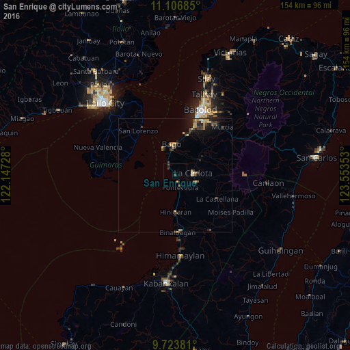
Analysis of San Enrique night lights 2016
Square area 10x10 km:
 0%
0%90-99
0%80-89
0.21%70-79
0.62%60-69
0%50-59
1.65%40-49
0.83%30-39
0.83%20-29
0.21%10-19
0.62%0-9
95.04%Square area 50x50 km:
0.03%90-99
0.11%80-89
0.45%70-79
0.51%60-69
0.41%50-59
0.29%40-49
0.6%30-39
0.57%20-29
0.74%10-19
1.39%0-9
94.9%Clear (daylight) street map image can be seen on geolist.org.
Map coordinates:
11° 6' 24.7" North, 122° 8' 50.2" East
10° 24' 58" North, 122° 51' 1.4" East
9° 43' 25.7" North, 123° 33' 12.7" East
Some cities around San Enrique sort by population:
• Bago City
13.2 km =8.2 mi,  351°
351°
• La Carlota
7.8 km =4.8 mi,  83°
83°
• Pulupandan
12.8 km =8 mi,  335°
335°
• Pacol
5.3 km =3.3 mi,  315°
315°
• Miranda
12.7 km =7.9 mi,  166°
166°
• Pontevedra
5 km =3.1 mi,  157°
157°
• Busay
14.1 km =8.8 mi,  16°
16°
• Napoles
11.1 km =6.9 mi,  27°
27°
1690119 (p: 9,818)
Sources (retrieved 2019-11-25):
» Earth at Night: Flat Maps 2012, 2016