Antipolo night lights from space
Night Light of Antipolo (Calabarzon) from space (Philippines) Src. Average luminocity for 10x10km area is 85.1407% and for 50x50km: 42.3677%.
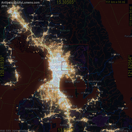

Analysis of Antipolo night lights 2016
Square area 10x10 km:
 36.58%
90-99
21.43%80-89
6.93%70-79
16.23%60-69
9.09%50-59
3.46%40-49
1.08%30-39
4.11%20-29
1.08%10-19
0%0-9
0%Square area 50x50 km:
13.96%90-99
7.97%80-89
4.43%70-79
6.85%60-69
6.42%50-59
2.65%40-49
3.12%30-39
4.94%20-29
6.27%10-19
7.56%0-9
35.82%Clear (daylight) street map image can be seen on geolist.org.
Map coordinates:
15° 18' 18.2" North, 120° 25' 9.8" East
14° 37' 32.8" North, 121° 7' 21" East
13° 56' 39.8" North, 121° 49' 32.3" East
Some cities around Antipolo sort by population:
• Quezon City
8.1 km =5 mi,  288°
288°
• Pasig City
7.9 km =4.9 mi,  236°
236°
• Mandaluyong City
10 km =6.2 mi, 241°
• Cainta
5.2 km =3.2 mi,  180°
180°
• Taytay
7.5 km =4.7 mi,  171°
171°
• San Mateo
8.1 km =5 mi,  0°
0°
• Malanday
9.1 km =5.7 mi,  5°
5°
• Calumpang
3.5 km =2.2 mi,  264°
264°
1730501 (p: 549,543)
Sources (retrieved 2019-11-25):
» NASA, Earths city lights 1995
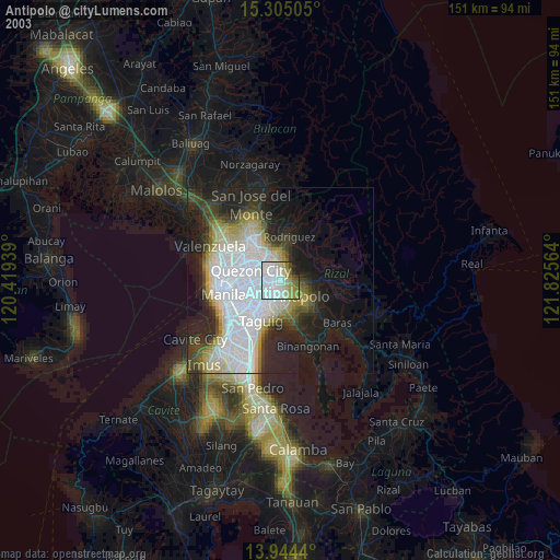
» NASA city lights 2003
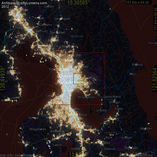
» Earth at Night: Flat Maps 2012, 2016