San Mateo night lights from space
Night Light of San Mateo (Calabarzon) from space (Philippines) Src. Average luminocity for 10x10km area is 66.9525% and for 50x50km: 38.47%.
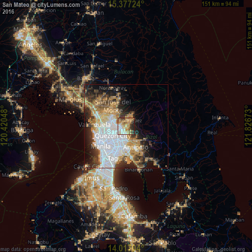
Analysis of San Mateo night lights 2016
Square area 10x10 km:
 9.3%
9.3%90-99
13.84%80-89
9.92%70-79
17.56%60-69
14.67%50-59
10.54%40-49
6.2%30-39
6.82%20-29
9.92%10-19
1.24%0-9
0%Square area 50x50 km:
12.61%90-99
6.2%80-89
3.47%70-79
6.32%60-69
6.24%50-59
2.78%40-49
3.37%30-39
5.14%20-29
6.59%10-19
8.95%0-9
38.33%Clear (daylight) street map image can be seen on geolist.org.
Map coordinates:
15° 22' 38.1" North, 120° 25' 13.7" East
14° 41' 53.5" North, 121° 7' 25" East
14° 1' 1.3" North, 121° 49' 36.2" East
Some cities around San Mateo sort by population:
• Quezon City
9.6 km =6 mi,  234°
234°
• Antipolo
8.1 km =5 mi,  180°
180°
• Cainta
13.3 km =8.3 mi, 180°
• Rodriguez
10.7 km =6.6 mi,  50°
50°
• Bagong Pagasa
10.5 km =6.5 mi,  247°
247°
• Malanday
1.2 km =0.7 mi,  37°
37°
• Calumpang
9.1 km =5.7 mi,  203°
203°
• Del Monte
13 km =8.1 mi,  241°
241°
1689056 (p: 134,327)
Sources (retrieved 2019-11-25):
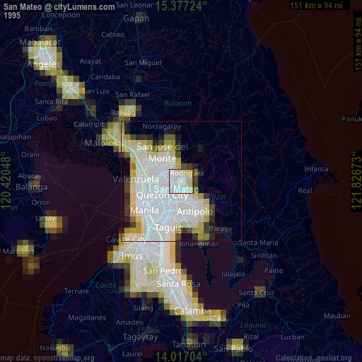
» NASA, Earths city lights 1995
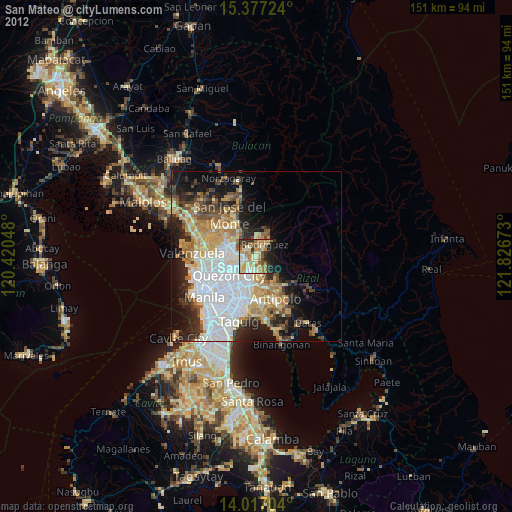
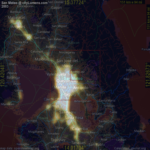
» NASA city lights 2003
» Earth at Night: Flat Maps 2012, 2016