Alfonso night lights from space
Night Light of Alfonso (Calabarzon) from space (Philippines) Src. Average luminocity for 10x10km area is 4.5584% and for 50x50km: 16.7914%.
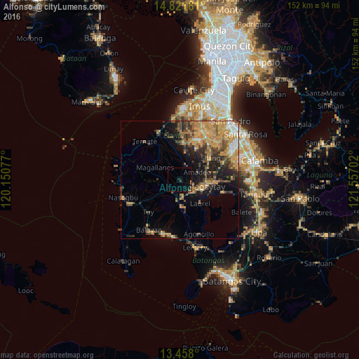
Analysis of Alfonso night lights 2016
Square area 10x10 km:
 0%
0%90-99
0%80-89
0%70-79
0.43%60-69
0.43%50-59
0.87%40-49
1.08%30-39
0.65%20-29
1.08%10-19
4.55%0-9
90.91%Square area 50x50 km:
1.09%90-99
1.29%80-89
1.63%70-79
5.82%60-69
3.97%50-59
2.04%40-49
3.33%30-39
2.5%20-29
3.04%10-19
7.79%0-9
67.51%Clear (daylight) street map image can be seen on geolist.org.
Map coordinates:
14° 49' 17.8" North, 120° 9' 2.8" East
14° 8' 27" North, 120° 51' 14" East
13° 27' 28.8" North, 121° 33' 25.3" East
Some cities around Alfonso sort by population:
• Tagaytay
10 km =6.2 mi,  120°
120°
• Indang
6.5 km =4 mi,  22°
22°
• Mendez-Nuñez
5.8 km =3.6 mi,  103°
103°
• Amadeo
8.2 km =5.1 mi,  66°
66°
• General Emilio Aguinaldo
7.9 km =4.9 mi,  307°
307°
• Laurel
11.8 km =7.3 mi,  143°
143°
• Aga
7.4 km =4.6 mi,  228°
228°
• Pantijan No 2
11.8 km =7.3 mi,  330°
330°
1731537 (p: 9,446)
Sources (retrieved 2019-11-25):
» Earth at Night: Flat Maps 2012, 2016