Salinera Colán night lights from space
Night Light of Salinera Colán (Piura) from space (Peru) Src. Average luminocity for 10x10km area is 21.9917% and for 50x50km: 4.996%.
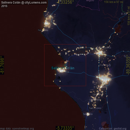
Analysis of Salinera Colán night lights 2016
Square area 10x10 km:
 0.62%
0.62%90-99
0.21%80-89
10.12%70-79
1.45%60-69
1.65%50-59
1.45%40-49
2.07%30-39
4.55%20-29
7.64%10-19
23.76%0-9
46.49%Square area 50x50 km:
0.32%90-99
0.34%80-89
1.83%70-79
0.49%60-69
0.14%50-59
0.36%40-49
0.66%30-39
0.85%20-29
1.06%10-19
3.24%0-9
90.72%Clear (daylight) street map image can be seen on geolist.org.
Map coordinates:
4° 19' 57.2" South, 81° 46' 11.3" West
5° 1' 60" South, 81° 4' 0" West
5° 44' 0.1" South, 80° 21' 48.8" West
Some cities around Salinera Colán sort by population:
• Piura
51.3 km =31.9 mi,  110°
110°
• Sullana
44.6 km =27.7 mi,  71°
71°
• Catacaos
49.8 km =30.9 mi,  121°
121°
• Paita
8.2 km =5.1 mi,  220°
220°
• Marcavelica
43.6 km =27.1 mi, 66°
• Querecotillo
51.5 km =32 mi, 65°
• La Huaca
18 km =11.2 mi,  41°
41°
• Salitral
47 km =29.2 mi, 65°
3692729 (p: 14,210)
Sources (retrieved 2019-11-25):
» Earth at Night: Flat Maps 2012, 2016