Palpa night lights from space
Night Light of Palpa (Ica) from space (Peru) Src. Average luminocity for 10x10km area is 10.5909% and for 50x50km: 0.7216%.
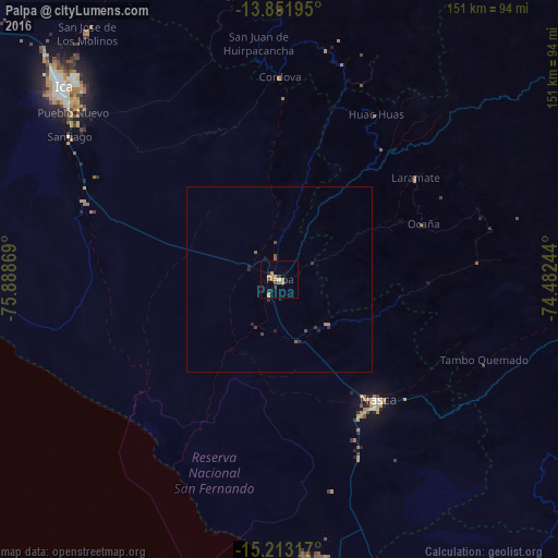
Analysis of Palpa night lights 2016
Square area 10x10 km:
 0.43%
0.43%90-99
0.43%80-89
0%70-79
4.55%60-69
3.46%50-59
1.08%40-49
0%30-39
1.73%20-29
2.38%10-19
2.81%0-9
83.12%Square area 50x50 km:
0.02%90-99
0.02%80-89
0%70-79
0.2%60-69
0.2%50-59
0.15%40-49
0.13%30-39
0.16%20-29
0.29%10-19
0.15%0-9
98.69%Clear (daylight) street map image can be seen on geolist.org.
Map coordinates:
13° 51' 7" South, 75° 53' 19.3" West
14° 32' 1" South, 75° 11' 8" West
15° 12' 47.4" South, 74° 28' 56.8" West
Some cities around Palpa sort by population:
• Ica
78.1 km =48.5 mi,  311°
311°
• Nazca
42.4 km =26.3 mi,  141°
141°
• Minas de Marcona
75.9 km =47.2 mi,  173°
173°
• Puquio
114.7 km =71.3 mi,  99°
99°
• Santiago
68.6 km =42.6 mi,  304°
304°
• Subtanjalla
84.1 km =52.3 mi, 312°
• Los Aquijes
73 km =45.4 mi, 311°
• San Juan Bautista
83 km =51.6 mi, 314°
3933345 (p: 5,883)
Sources (retrieved 2019-11-25):
» Earth at Night: Flat Maps 2012, 2016