Minas de Marcona night lights from space
Night Light of Minas de Marcona (Ica) from space (Peru) Src. Average luminocity for 10x10km area is 10.2211% and for 50x50km: 1.3334%.
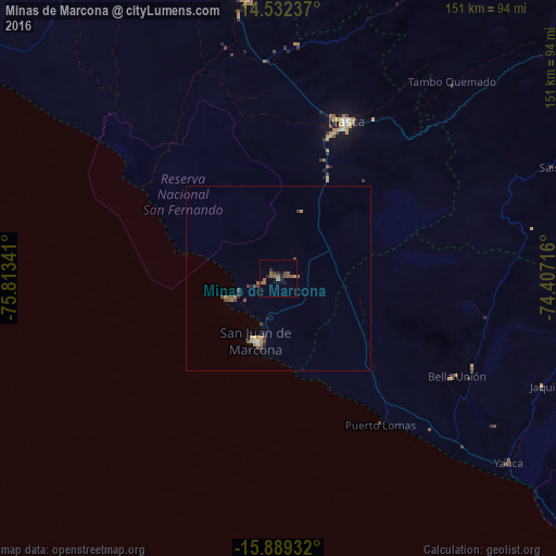
Analysis of Minas de Marcona night lights 2016
Square area 10x10 km:
 0%
0%90-99
0%80-89
0%70-79
0.83%60-69
5.17%50-59
4.75%40-49
1.65%30-39
1.24%20-29
2.69%10-19
2.27%0-9
81.4%Square area 50x50 km:
0.03%90-99
0.06%80-89
0.04%70-79
0.25%60-69
0.4%50-59
0.31%40-49
0.34%30-39
0.29%20-29
0.24%10-19
0.16%0-9
97.88%Clear (daylight) street map image can be seen on geolist.org.
Map coordinates:
14° 31' 56.5" South, 75° 48' 48.3" West
15° 12' 43" South, 75° 6' 37" West
15° 53' 21.6" South, 74° 24' 25.8" West
Some cities around Minas de Marcona sort by population:
• Ica
143.6 km =89.2 mi,  332°
332°
• Nazca
46.2 km =28.7 mi,  23°
23°
• Puquio
119.4 km =74.2 mi,  61°
61°
• Santiago
131.2 km =81.5 mi, 330°
• Los Aquijes
138.8 km =86.2 mi, 333°
• Coracora
143.8 km =89.4 mi,  82°
82°
• Palpa
75.9 km =47.2 mi,  353°
353°
• Tambo
135.4 km =84.1 mi,  70°
70°
3935288 (p: 15,478)
Sources (retrieved 2019-11-25):
» Earth at Night: Flat Maps 2012, 2016