La Breita night lights from space
Night Light of La Breita (Piura) from space (Peru) Src. Average luminocity for 10x10km area is 0% and for 50x50km: 0.4564%.
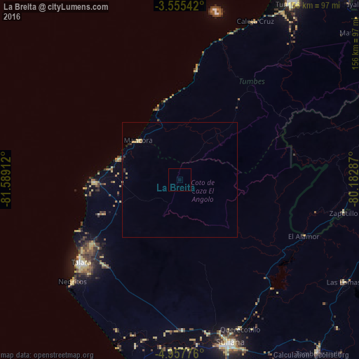
Analysis of La Breita night lights 2016
Square area 10x10 km:
 0%
0%90-99
0%80-89
0%70-79
0%60-69
0%50-59
0%40-49
0%30-39
0%20-29
0%10-19
0%0-9
100%Square area 50x50 km:
0%90-99
0%80-89
0.18%70-79
0.11%60-69
0.03%50-59
0%40-49
0.03%30-39
0.1%20-29
0.11%10-19
0.05%0-9
99.38%Clear (daylight) street map image can be seen on geolist.org.
Map coordinates:
3° 33' 19.5" South, 81° 35' 20.8" West
4° 15' 24.9" South, 80° 53' 9.6" West
4° 57' 27.9" South, 80° 10' 58.3" West
Some cities around La Breita sort by population:
• Talara
55.7 km =34.6 mi,  230°
230°
• Marcavelica
71.9 km =44.7 mi,  163°
163°
• Querecotillo
69.9 km =43.4 mi, 157°
• Zorritos
68.1 km =42.3 mi,  19°
19°
• El Alto
36.7 km =22.8 mi,  267°
267°
• Máncora
24.4 km =15.2 mi,  312°
312°
• Papayal
25.9 km =16.1 mi,  39°
39°
• Salitral
70.5 km =43.8 mi, 161°
3814568 (p: 17,693)
Sources (retrieved 2019-11-25):
» Earth at Night: Flat Maps 2012, 2016