El Alto night lights from space
Night Light of El Alto (Piura) from space (Peru) Src. Average luminocity for 10x10km area is 19.6429% and for 50x50km: 2.7824%.
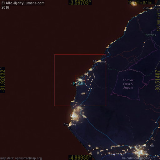
Analysis of El Alto night lights 2016
Square area 10x10 km:
 0.43%
0.43%90-99
0.43%80-89
7.36%70-79
1.3%60-69
1.73%50-59
4.33%40-49
3.46%30-39
3.03%20-29
4.11%10-19
7.58%0-9
66.23%Square area 50x50 km:
0.02%90-99
0.06%80-89
0.89%70-79
0.27%60-69
0.29%50-59
0.37%40-49
0.58%30-39
0.4%20-29
0.65%10-19
0.94%0-9
95.53%Clear (daylight) street map image can be seen on geolist.org.
Map coordinates:
3° 34' 1.3" South, 81° 55' 13.2" West
4° 16' 6.6" South, 81° 13' 1.9" West
4° 58' 9.7" South, 80° 30' 50.7" West
Some cities around El Alto sort by population:
• Talara
34.9 km =21.7 mi,  190°
190°
• Marcavelica
88.4 km =54.9 mi,  140°
140°
• La Breita
36.7 km =22.8 mi,  87°
87°
• Salinera Colán
86.7 km =53.9 mi,  168°
168°
• Máncora
26 km =16.2 mi,  46°
46°
• La Huaca
77 km =47.8 mi,  158°
158°
• Papayal
57.3 km =35.6 mi,  68°
68°
• Salitral
88.4 km =54.9 mi, 137°
3697441 (p: 9,303)
Sources (retrieved 2019-11-25):
» Earth at Night: Flat Maps 2012, 2016