Zorritos night lights from space
Night Light of Zorritos (Tumbes) from space (Peru) Src. Average luminocity for 10x10km area is 5.0411% and for 50x50km: 2.4584%.
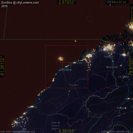
Analysis of Zorritos night lights 2016
Square area 10x10 km:
 0%
0%90-99
0%80-89
1.73%70-79
0.43%60-69
0%50-59
0.65%40-49
2.38%30-39
0.87%20-29
1.73%10-19
0.87%0-9
91.34%Square area 50x50 km:
0.12%90-99
0.16%80-89
0.35%70-79
0.38%60-69
0.38%50-59
0.24%40-49
0.46%30-39
0.6%20-29
0.58%10-19
1.4%0-9
95.34%Clear (daylight) street map image can be seen on geolist.org.
Map coordinates:
2° 58' 42.7" South, 81° 22' 52.8" West
3° 40' 49.7" South, 80° 40' 41.5" West
4° 22' 54.6" South, 79° 58' 30.3" West
Some cities around Zorritos sort by population:
• Tumbes
28.1 km =17.5 mi,  63°
63°
• Santa Rosa, EC
83.8 km =52.1 mi,  72°
72°
• Huaquillas, EC
54.6 km =33.9 mi, 65°
• La Breita
68.1 km =42.3 mi,  199°
199°
• Zarumilla
49.1 km =30.5 mi, 66°
• Aguas Verdes
52.9 km =32.9 mi, 65°
• Máncora
62.7 km =39 mi,  220°
220°
• Papayal
44.6 km =27.7 mi,  188°
188°
3690608 (p: 12,261)
Sources (retrieved 2019-11-25):
» Earth at Night: Flat Maps 2012, 2016