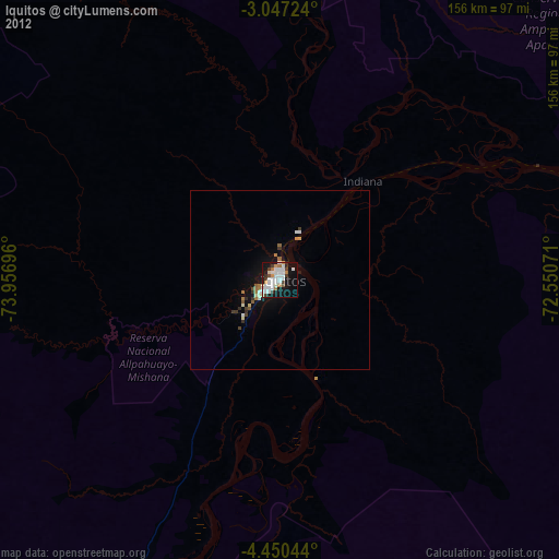
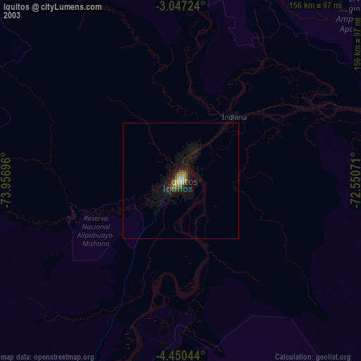
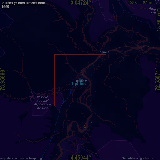
Iquitos night lights from space
Night Light of Iquitos (Loreto) from space (Peru) Src. Average luminocity for 10x10km area is 48.2532% and for 50x50km: 3.579%.
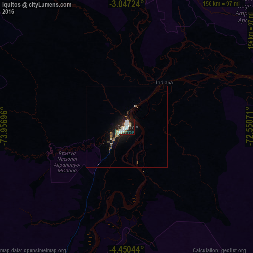
Analysis of Iquitos night lights 2016
Square area 10x10 km:
 16.02%
90-99
14.07%80-89
2.6%70-79
1.73%60-69
3.68%50-59
3.25%40-49
1.52%30-39
5.41%20-29
13.64%10-19
33.55%0-9
4.55%Square area 50x50 km:
0.69%90-99
0.67%80-89
0.2%70-79
0.24%60-69
0.42%50-59
0.42%40-49
0.16%30-39
0.59%20-29
0.88%10-19
3.65%0-9
92.06%Clear (daylight) street map image can be seen on geolist.org.
Map coordinates:
3° 2' 50.1" South, 73° 57' 25.1" West
3° 44' 56.8" South, 73° 15' 13.8" West
4° 27' 1.6" South, 72° 33' 2.6" West
Some cities around Iquitos sort by population:
• Yurimaguas
397.9 km =247.2 mi,  233°
233°
• Leticia, CO
371.1 km =230.6 mi,  98°
98°
• Tabatinga, BR
371.6 km =230.9 mi, 98°
• Benjamin Constant, BR
364.1 km =226.2 mi, 101°
• Lagunas
314.7 km =195.5 mi,  238°
238°
• San Antonio del Estrecho
158.4 km =98.4 mi,  24°
24°
• Barranca
398.1 km =247.4 mi,  252°
252°
• Ramón Castilla
370.1 km =230 mi, 98°
3696183 (p: 437,620)
Sources (retrieved 2019-11-25):
» NASA, Earths city lights 1995
» NASA city lights 2003
» Earth at Night: Flat Maps 2012, 2016