Ambo night lights from space
Night Light of Ambo (Huanuco) from space (Peru) Src. Average luminocity for 10x10km area is 4.5124% and for 50x50km: 1.9111%.
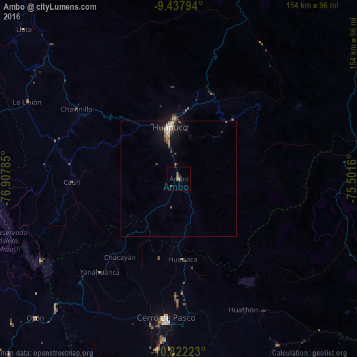
Analysis of Ambo night lights 2016
Square area 10x10 km:
 0%
0%90-99
0%80-89
0%70-79
0.83%60-69
3.1%50-59
0.21%40-49
1.03%30-39
0.62%20-29
1.45%10-19
0.62%0-9
92.15%Square area 50x50 km:
0.18%90-99
0.27%80-89
0.03%70-79
0.41%60-69
0.35%50-59
0.29%40-49
0.21%30-39
0.29%20-29
0.37%10-19
1.72%0-9
95.88%Clear (daylight) street map image can be seen on geolist.org.
Map coordinates:
9° 26' 16.6" South, 76° 54' 28.3" West
10° 7' 51" South, 76° 12' 17" West
10° 49' 20" South, 75° 30' 5.8" West
Some cities around Ambo sort by population:
• Huánuco
22.6 km =14 mi,  349°
349°
• Cerro de Pasco
59.9 km =37.2 mi,  185°
185°
• Chaupimarca
41.6 km =25.8 mi,  222°
222°
• Yanacancha
49.8 km =30.9 mi,  255°
255°
• Oyón
86.1 km =53.5 mi,  226°
226°
• Yanahuanca
53.6 km =33.3 mi, 216°
• San Miguel de Cauri
45.8 km =28.5 mi,  268°
268°
• Tinyahuarco
71.2 km =44.2 mi, 186°
3947956 (p: 6,865)
Sources (retrieved 2019-11-25):
» Earth at Night: Flat Maps 2012, 2016