Triyuga night lights from space
Night Light of Triyuga (Province 1) from space (Nepal) Src. Average luminocity for 10x10km area is 0.7937% and for 50x50km: 1.0738%.
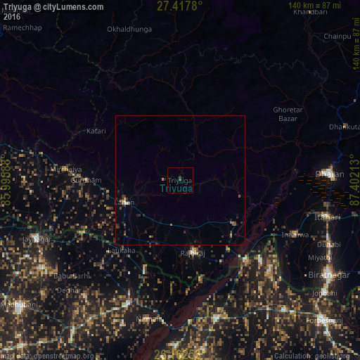
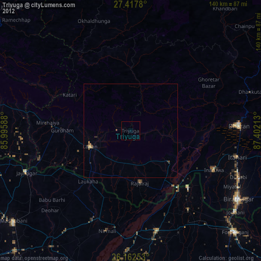
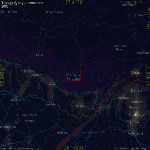
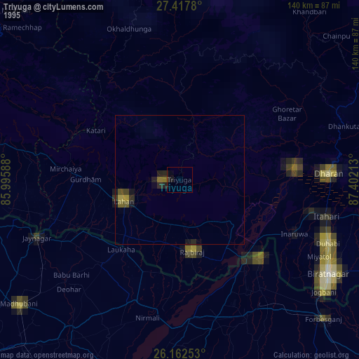
Analysis of Triyuga night lights 2016
Square area 10x10 km:
 0%
0%90-99
0%80-89
0%70-79
0%60-69
0%50-59
0%40-49
0.79%30-39
0.79%20-29
0%10-19
0%0-9
98.41%Square area 50x50 km:
0%90-99
0.09%80-89
0%70-79
0.14%60-69
0.12%50-59
0.2%40-49
0.21%30-39
0.45%20-29
0.39%10-19
0.54%0-9
97.86%Clear (daylight) street map image can be seen on geolist.org.
Map coordinates:
27° 25' 4.1" North, 85° 59' 45.2" East
26° 47' 30.8" North, 86° 41' 56.4" East
26° 9' 45.1" North, 87° 24' 7.7" East
Some cities around Triyuga sort by population:
• Dharān
57.7 km =35.9 mi,  87°
87°
• Inaruwa
49.1 km =30.5 mi,  114°
114°
• Rājbirāj
28.5 km =17.7 mi,  170°
170°
• Lahān
22.9 km =14.2 mi,  249°
249°
• Bhawanipur, IN
49.8 km =30.9 mi,  139°
139°
• Siraha
51.1 km =31.8 mi, 252°
• Bīrpur, IN
44.3 km =27.5 mi, 135°
• Nirmāli, IN
54.3 km =33.7 mi,  192°
192°
8410807 (p: 71,405)
Sources (retrieved 2019-11-25):
» NASA, Earths city lights 1995
» NASA city lights 2003
» Earth at Night: Flat Maps 2012, 2016