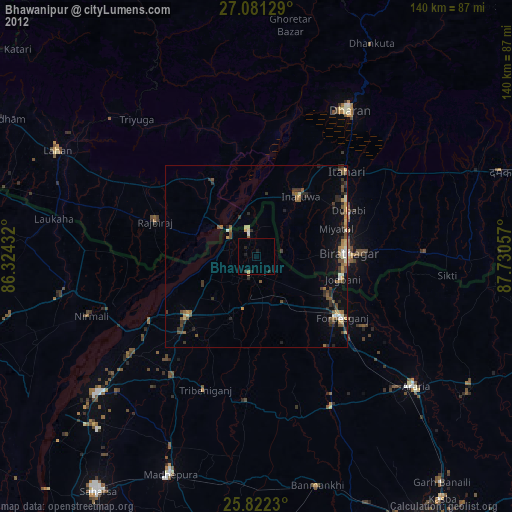
Bhawanipur night lights from space
Night Light of Bhawanipur (Bihar) from space (India) Src. Average luminocity for 10x10km area is 38.7367% and for 50x50km: 18.4776%.
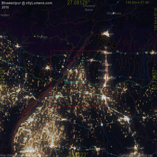
Analysis of Bhawanipur night lights 2016
Square area 10x10 km:
 1.33%
1.33%90-99
3.22%80-89
4.36%70-79
5.87%60-69
7.58%50-59
10.23%40-49
8.52%30-39
6.44%20-29
21.21%10-19
31.25%0-9
0%Square area 50x50 km:
0.75%90-99
1.52%80-89
1.05%70-79
1.6%60-69
2.62%50-59
3.92%40-49
4.76%30-39
5.93%20-29
8.7%10-19
20.37%0-9
48.79%Clear (daylight) street map image can be seen on geolist.org.
Map coordinates:
27° 4' 52.6" North, 86° 19' 27.6" East
26° 27' 12.7" North, 87° 1' 38.8" East
25° 49' 20.3" North, 87° 43' 50.1" East
Some cities around Bhawanipur sort by population:
• Biratnagar, NP
24.2 km =15 mi,  89°
89°
• Inaruwa, NP
20.8 km =12.9 mi,  35°
35°
• Forbesganj
29.1 km =18.1 mi,  125°
125°
• Shahbazpur
30.8 km =19.1 mi,  122°
122°
• Jogbani
24.4 km =15.2 mi,  104°
104°
• Rājbirāj, NP
29.4 km =18.3 mi,  289°
289°
• Chhātāpur
26.1 km =16.2 mi,  184°
184°
• Bīrpur
6.3 km =3.9 mi,  345°
345°
7626554 (p: 27,000)
Sources (retrieved 2019-11-25):
» Earth at Night: Flat Maps 2012, 2016