Madhyapur Thimi night lights from space
Night Light of Madhyapur Thimi (Province 3) from space (Nepal) Src. Average luminocity for 10x10km area is 58.5714% and for 50x50km: 9.7302%.
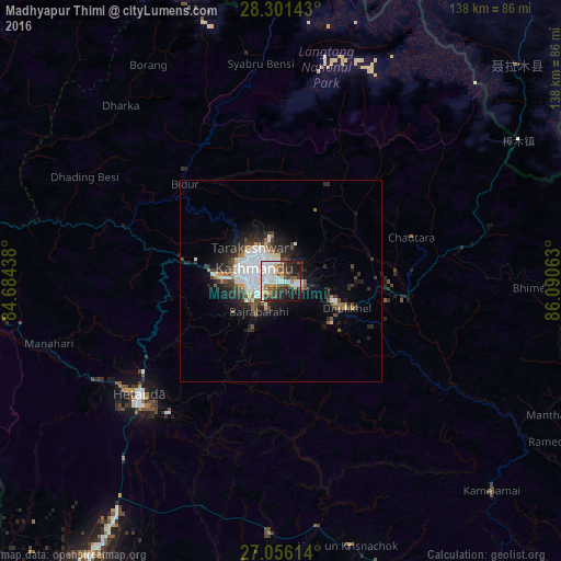
Analysis of Madhyapur Thimi night lights 2016
Square area 10x10 km:
 14.68%
90-99
17.66%80-89
3.17%70-79
4.76%60-69
5.56%50-59
7.14%40-49
11.71%30-39
6.55%20-29
16.07%10-19
12.1%0-9
0.6%Square area 50x50 km:
2.51%90-99
2.01%80-89
0.51%70-79
0.58%60-69
0.84%50-59
0.94%40-49
1.45%30-39
1.65%20-29
3.14%10-19
4.95%0-9
81.41%Clear (daylight) street map image can be seen on geolist.org.
Map coordinates:
28° 18' 5.1" North, 84° 41' 3.8" East
27° 40' 50" North, 85° 23' 15" East
27° 3' 22.1" North, 86° 5' 26.3" East
Some cities around Madhyapur Thimi sort by population:
• Kathmandu
7 km =4.3 mi,  289°
289°
• Pātan
7.2 km =4.5 mi,  266°
266°
• Kirtipur
10.8 km =6.7 mi, 268°
• Panauti̇̄
16.5 km =10.3 mi,  130°
130°
• Banepā
14.3 km =8.9 mi,  112°
112°
• Dhulikhel
16.6 km =10.3 mi, 113°
• kankrabari Dovan
9.1 km =5.7 mi, 129°
• Hari Bdr Tamang House
9.1 km =5.7 mi, 129°
8411054 (p: 83,036)
Sources (retrieved 2019-11-25):
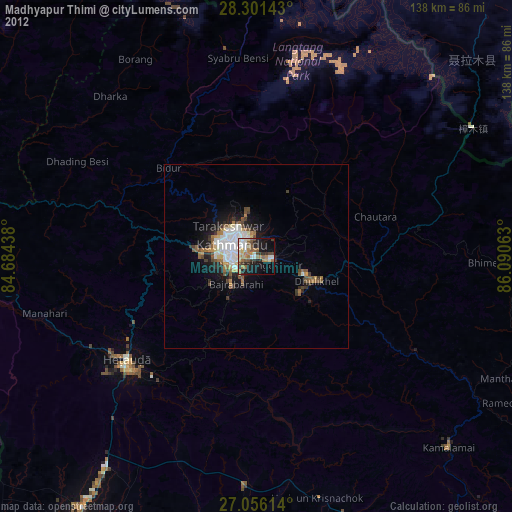
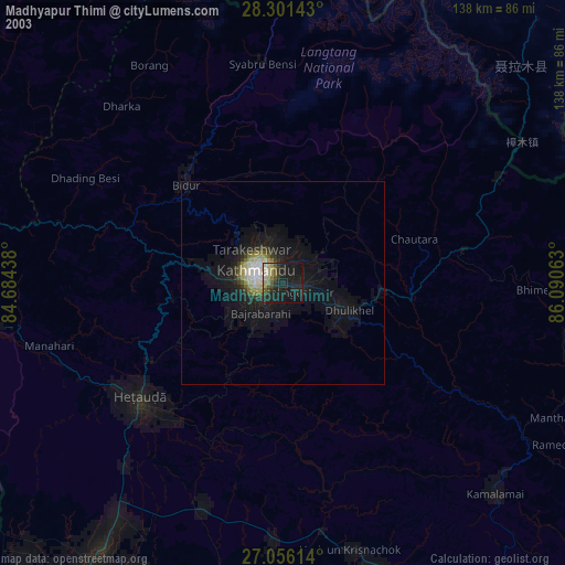
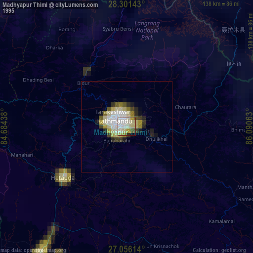
» NASA, Earths city lights 1995
» NASA city lights 2003
» Earth at Night: Flat Maps 2012, 2016