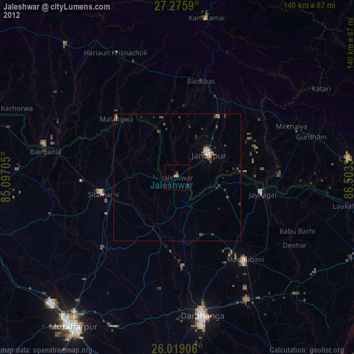
Jaleshwar night lights from space
Night Light of Jaleshwar (Province 2) from space (Nepal) Src. Average luminocity for 10x10km area is 6.697% and for 50x50km: 8.8627%.
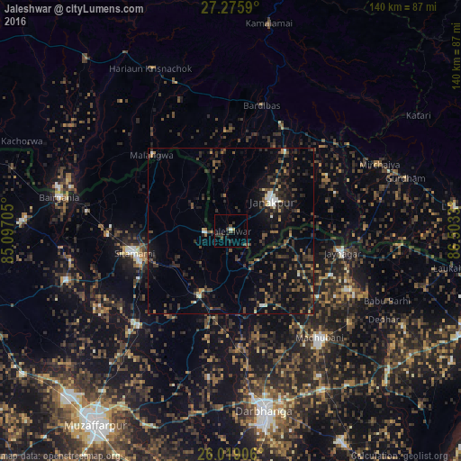
Analysis of Jaleshwar night lights 2016
Square area 10x10 km:
 0%
0%90-99
0.76%80-89
0.19%70-79
0.57%60-69
0%50-59
0.38%40-49
3.98%30-39
1.89%20-29
3.41%10-19
2.08%0-9
86.74%Square area 50x50 km:
0.35%90-99
0.6%80-89
0.36%70-79
0.46%60-69
0.92%50-59
1.43%40-49
2.58%30-39
2.85%20-29
4.27%10-19
7.82%0-9
78.34%Clear (daylight) street map image can be seen on geolist.org.
Map coordinates:
27° 16' 33.2" North, 85° 5' 49.4" East
26° 38' 57.2" North, 85° 48' 0.6" East
26° 1' 8.6" North, 86° 30' 11.9" East
Some cities around Jaleshwar sort by population:
• Janakpur
15.3 km =9.5 mi,  54°
54°
• Madhubani, IN
42.5 km =26.4 mi,  140°
140°
• Sītāmarhi, IN
31.4 km =19.5 mi,  258°
258°
• Siraha
40.5 km =25.2 mi,  89°
89°
• Jaynagar, IN
34.2 km =21.3 mi,  101°
101°
• Malaṅgawā
33.2 km =20.6 mi,  313°
313°
• Dumra, IN
29.3 km =18.2 mi,  251°
251°
• Pupri, IN
22.1 km =13.7 mi,  205°
205°
1283323 (p: 23,573)
Sources (retrieved 2019-11-25):
» Earth at Night: Flat Maps 2012, 2016