Tongelre night lights from space
Night Light of Tongelre (North Brabant) from space (Netherlands) Src. Average luminocity for 10x10km area is 69.1003% and for 50x50km: 21.0438%.
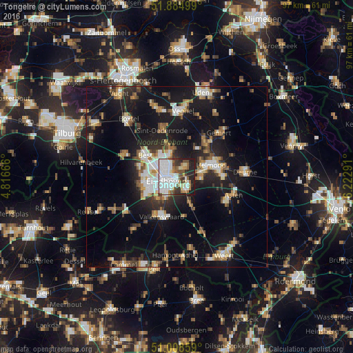
Analysis of Tongelre night lights 2016
Square area 10x10 km:
 22.59%
90-99
22.33%80-89
5.88%70-79
2.94%60-69
6.42%50-59
6.82%40-49
5.88%30-39
8.29%20-29
14.44%10-19
4.41%0-9
0%Square area 50x50 km:
2.97%90-99
3.62%80-89
2.04%70-79
2.41%60-69
2.51%50-59
2.9%40-49
2.39%30-39
2.8%20-29
5.65%10-19
19.85%0-9
52.85%Clear (daylight) street map image can be seen on geolist.org.
Map coordinates:
51° 53' 6" North, 4° 48' 60" East
51° 26' 56" North, 5° 31' 11.2" East
51° 0' 30.9" North, 6° 13' 22.5" East
Some cities around Tongelre sort by population:
• Eindhoven
3 km =1.9 mi,  252°
252°
• Geldrop
4.1 km =2.5 mi,  137°
137°
• Nuenen
3.3 km =2.1 mi,  44°
44°
• Mierlo
7 km =4.3 mi,  98°
98°
• De Doornakkers
1.4 km =0.9 mi,  213°
213°
• Coevering
5.2 km =3.2 mi,  132°
132°
• Woenselse Heide
5.3 km =3.3 mi,  316°
316°
• Vaartbroek
3.7 km =2.3 mi,  336°
336°
2746215 (p: 19,680)
Sources (retrieved 2019-11-25):
» Earth at Night: Flat Maps 2012, 2016