Sint Willebrord night lights from space
Night Light of Sint Willebrord (North Brabant) from space (Netherlands) Src. Average luminocity for 10x10km area is 33.7005% and for 50x50km: 22.2285%.
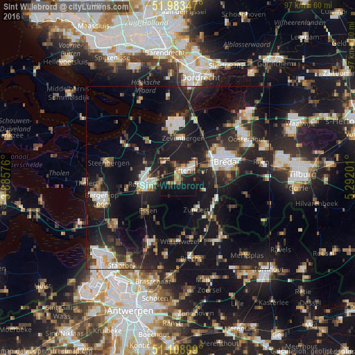
Analysis of Sint Willebrord night lights 2016
Square area 10x10 km:
 3.74%
3.74%90-99
6.02%80-89
3.88%70-79
4.14%60-69
6.28%50-59
3.88%40-49
2.81%30-39
3.48%20-29
11.36%10-19
37.97%0-9
16.44%Square area 50x50 km:
3.37%90-99
3.75%80-89
1.8%70-79
1.84%60-69
2.05%50-59
2.51%40-49
2.5%30-39
3.94%20-29
8.52%10-19
26.67%0-9
43.06%Clear (daylight) street map image can be seen on geolist.org.
Map coordinates:
51° 59' 0.5" North, 3° 53' 8.7" East
51° 32' 54" North, 4° 35' 20" East
51° 6' 32.4" North, 5° 17' 31.2" East
Some cities around Sint Willebrord sort by population:
• Breda
13.6 km =8.5 mi,  71°
71°
• Roosendaal
8.8 km =5.5 mi,  257°
257°
• Essen, BE
12.2 km =7.6 mi,  222°
222°
• Prinsenbeek
10.2 km =6.3 mi,  56°
56°
• Princenhage
10.8 km =6.7 mi, 73°
• Zundert
9.7 km =6 mi,  151°
151°
• Klundert
13.5 km =8.4 mi,  343°
343°
• Oud Gastel
9.9 km =6.2 mi,  295°
295°
2747210 (p: 8,655)
Sources (retrieved 2019-11-25):
» Earth at Night: Flat Maps 2012, 2016