Roermond night lights from space
Night Light of Roermond (Limburg) from space (Netherlands) Src. Average luminocity for 10x10km area is 38.4278% and for 50x50km: 16.5638%.
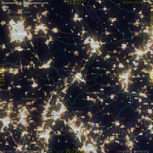
Analysis of Roermond night lights 2016
Square area 10x10 km:
 4.95%
4.95%90-99
7.35%80-89
5.48%70-79
3.21%60-69
7.49%50-59
2.67%40-49
4.41%30-39
5.21%20-29
12.3%10-19
42.25%0-9
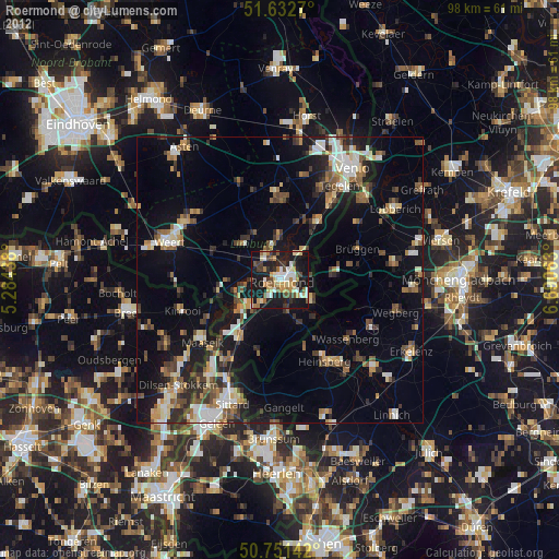
4.68%Square area 50x50 km:
2.01%90-99
2.52%80-89
1.53%70-79
1.61%60-69
1.83%50-59
2.35%40-49
2.89%30-39
2.84%20-29
4.36%10-19
13.55%0-9
64.5%Clear (daylight) street map image can be seen on geolist.org.
Map coordinates:
51° 37' 57.7" North, 5° 17' 3.8" East
51° 11' 39" North, 5° 59' 15" East
50° 45' 5.1" North, 6° 41' 26.3" East
Some cities around Roermond sort by population:
• Brüggen, DE
14.6 km =9.1 mi,  69°
69°
• Haelen
5.1 km =3.2 mi,  335°
335°
• Waldfeucht, DE
14.2 km =8.8 mi,  179°
179°
• Panningen
14.7 km =9.1 mi,  357°
357°
• Heythuysen
8.8 km =5.5 mi,  315°
315°
• Reuver
11.8 km =7.3 mi,  32°
32°
• Maasbracht
9.3 km =5.8 mi,  229°
229°
• Helden
13.9 km =8.6 mi,  3°
3°
2748000 (p: 44,975)
Sources (retrieved 2019-11-25):
» Earth at Night: Flat Maps 2012, 2016