Raalte night lights from space
Night Light of Raalte (Overijssel) from space (Netherlands) Src. Average luminocity for 10x10km area is 6.4179% and for 50x50km: 10.2931%.
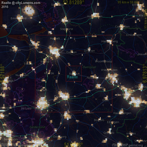
Analysis of Raalte night lights 2016
Square area 10x10 km:
100  1.01%
1.01%
90-99 1.01%
80-89 0%
70-79 0.51%
60-69 1.52%
50-59 0.88%
40-49 1.64%
30-39 0%
20-29 1.01%
10-19 0%
0-9 92.42%
1.01%90-99
1.01%80-89
0%70-79
0.51%60-69
1.52%50-59
0.88%40-49
1.64%30-39
0%20-29
1.01%10-19
0%0-9
92.42%Square area 50x50 km:
100 1.27%
90-99 1.61%
80-89 1.07%
70-79 1.05%
60-69 1.3%
50-59 1.72%
40-49 1.12%
30-39 1.01%
20-29 2.34%
10-19 8.66%
0-9 78.86%
1.27%90-99
1.61%80-89
1.07%70-79
1.05%60-69
1.3%50-59
1.72%40-49
1.12%30-39
1.01%20-29
2.34%10-19
8.66%0-9
78.86%Clear (daylight) street map image can be seen on geolist.org.
Map coordinates:
52° 48' 46.4" North, 5° 34' 18.8" East
52° 23' 9" North, 6° 16' 30" East
51° 57' 16.6" North, 6° 58' 41.3" East
Some cities around Raalte sort by population:
• Zwolle
18.7 km =11.6 mi,  319°
319°
• Deventer
16.4 km =10.2 mi,  207°
207°
• Dalfsen
14 km =8.7 mi,  355°
355°
• Hattem
17.4 km =10.8 mi,  304°
304°
• Ommen
18 km =11.2 mi,  33°
33°
• Heerde
15.9 km =9.9 mi,  270°
270°
• Heino
6.3 km =3.9 mi,  333°
333°
• Wijhe
9.5 km =5.9 mi, 270°
2748371 (p: 20,015)
Sources (retrieved 2019-11-25):
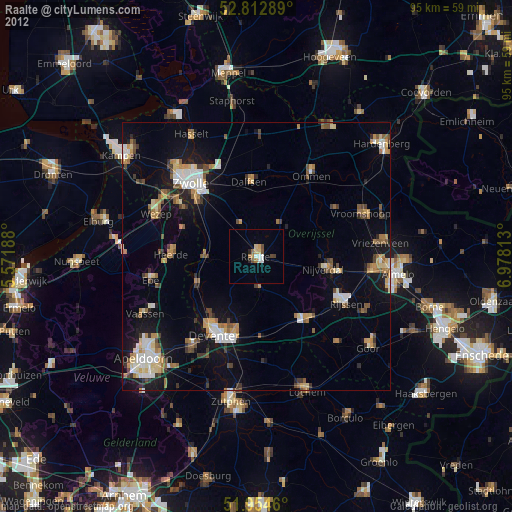
» Earth at Night: Flat Maps 2012, 2016