Zwolle night lights from space
Night Light of Zwolle (Overijssel) from space (Netherlands) Src. Average luminocity for 10x10km area is 43.3466% and for 50x50km: 7.0611%.
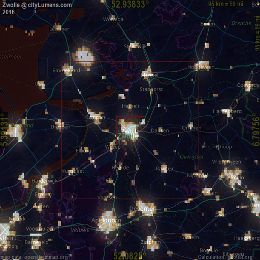
Analysis of Zwolle night lights 2016
Square area 10x10 km:
 9.26%
9.26%90-99
10.58%80-89
4.5%70-79
4.37%60-69
1.72%50-59
5.95%40-49
4.89%30-39
3.04%20-29
16.67%10-19
32.94%0-9
6.08%Square area 50x50 km:
0.74%90-99
1.03%80-89
0.57%70-79
0.75%60-69
1%50-59
1.25%40-49
0.87%30-39
0.69%20-29
1.39%10-19
5.4%0-9
86.31%Clear (daylight) street map image can be seen on geolist.org.
Map coordinates:
52° 56' 18" North, 5° 23' 28.7" East
52° 30' 45" North, 6° 5' 40" East
52° 4' 57" North, 6° 47' 51.2" East
Some cities around Zwolle sort by population:
• Kampen
13.3 km =8.3 mi,  290°
290°
• Dalfsen
11 km =6.8 mi,  90°
90°
• Hattem
4.7 km =2.9 mi,  206°
206°
• Heerde
14.4 km =8.9 mi,  194°
194°
• Hasselt
8.9 km =5.5 mi,  0°
0°
• Heino
12.6 km =7.8 mi,  131°
131°
• Frankhuis
2.3 km =1.4 mi,  307°
307°
• Wijhe
14.3 km =8.9 mi,  168°
168°
2743477 (p: 111,805)
Sources (retrieved 2019-11-25):
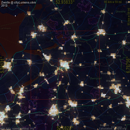
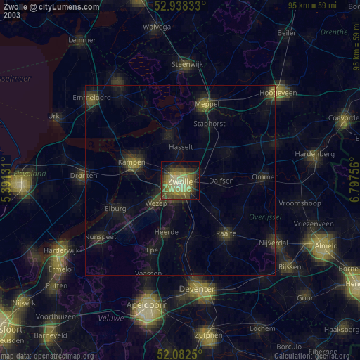
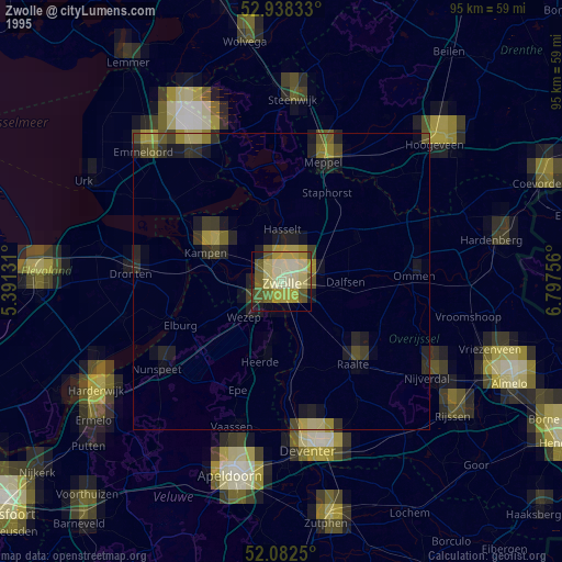
» NASA, Earths city lights 1995
» NASA city lights 2003
» Earth at Night: Flat Maps 2012, 2016