Hattem night lights from space
Night Light of Hattem (Gelderland) from space (Netherlands) Src. Average luminocity for 10x10km area is 29.0215% and for 50x50km: 7.1358%.
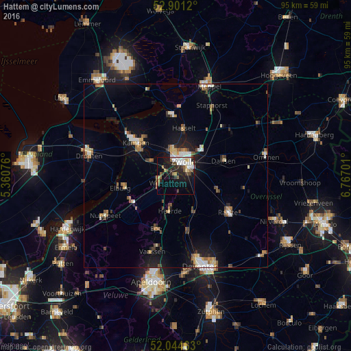
Analysis of Hattem night lights 2016
Square area 10x10 km:
100  5.68%
5.68%
90-99 5.93%
80-89 2.65%
70-79 1.77%
60-69 2.27%
50-59 4.92%
40-49 3.28%
30-39 3.03%
20-29 8.84%
10-19 22.98%
0-9 38.64%
5.68%90-99
5.93%80-89
2.65%70-79
1.77%60-69
2.27%50-59
4.92%40-49
3.28%30-39
3.03%20-29
8.84%10-19
22.98%0-9
38.64%Square area 50x50 km:
100 0.84%
90-99 1.08%
80-89 0.66%
70-79 0.75%
60-69 0.81%
50-59 1.3%
40-49 0.79%
30-39 0.69%
20-29 1.35%
10-19 5.54%
0-9 86.2%
0.84%90-99
1.08%80-89
0.66%70-79
0.75%60-69
0.81%50-59
1.3%40-49
0.79%30-39
0.69%20-29
1.35%10-19
5.54%0-9
86.2%Clear (daylight) street map image can be seen on geolist.org.
Map coordinates:
52° 54' 4.3" North, 5° 21' 38.7" East
52° 28' 30" North, 6° 3' 50" East
52° 2' 40.7" North, 6° 46' 1.2" East
Some cities around Hattem sort by population:
• Zwolle
4.7 km =2.9 mi,  26°
26°
• Kampen
13.6 km =8.5 mi,  310°
310°
• Dalfsen
13.7 km =8.5 mi,  72°
72°
• Heerde
9.9 km =6.2 mi,  189°
189°
• Hasselt
13.3 km =8.3 mi,  9°
9°
• Heino
12.2 km =7.6 mi,  110°
110°
• Frankhuis
5.6 km =3.5 mi,  2°
2°
• Wijhe
10.9 km =6.8 mi,  153°
153°
2754768 (p: 11,876)
Sources (retrieved 2019-11-25):
» Earth at Night: Flat Maps 2012, 2016