Middelharnis night lights from space
Night Light of Middelharnis (South Holland) from space (Netherlands) Src. Average luminocity for 10x10km area is 7.1569% and for 50x50km: 22.9866%.
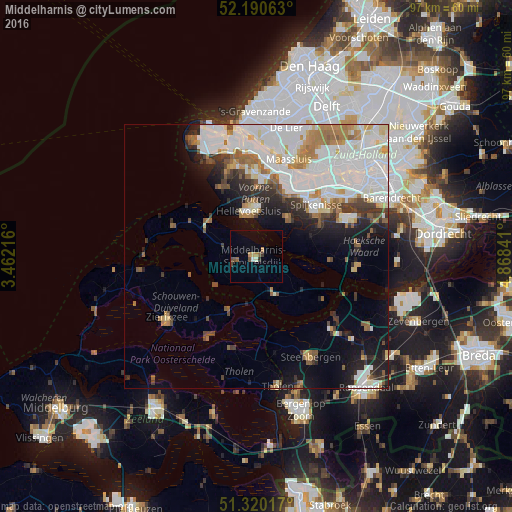
Analysis of Middelharnis night lights 2016
Square area 10x10 km:
 0.28%
0.28%90-99
0.84%80-89
0.42%70-79
0.84%60-69
1.12%50-59
1.26%40-49
1.96%30-39
1.12%20-29
0%10-19
0%0-9
92.16%Square area 50x50 km:
7.98%90-99
5.81%80-89
1.41%70-79
1.83%60-69
2.77%50-59
1.99%40-49
1.45%30-39
2.23%20-29
3.28%10-19
5.97%0-9
65.29%Clear (daylight) street map image can be seen on geolist.org.
Map coordinates:
52° 11' 26.3" North, 3° 27' 43.8" East
51° 45' 27" North, 4° 9' 55" East
51° 19' 12.6" North, 4° 52' 6.3" East
Some cities around Middelharnis sort by population:
• Spijkenisse
14.9 km =9.3 mi,  49°
49°
• Maassluis
19.3 km =12 mi,  17°
17°
• Oud-Beijerland
18.5 km =11.5 mi,  66°
66°
• Hellevoetsluis
8.7 km =5.4 mi,  345°
345°
• Rozenburg
17.3 km =10.7 mi, 19°
• Goedereede
14.4 km =8.9 mi,  297°
297°
• Ouddorp
17 km =10.6 mi,  290°
290°
• Dinteloord
19.6 km =12.2 mi,  134°
134°
2750884 (p: 17,554)
Sources (retrieved 2019-11-25):
» Earth at Night: Flat Maps 2012, 2016