Rozenburg night lights from space
Night Light of Rozenburg (South Holland) from space (Netherlands) Src. Average luminocity for 10x10km area is 85.0783% and for 50x50km: 42.5585%.
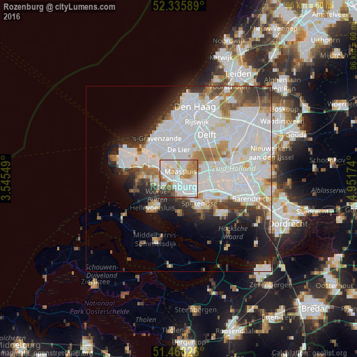
Analysis of Rozenburg night lights 2016
Square area 10x10 km:
 37.12%
90-99
26.14%80-89
3.41%70-79
10.61%60-69
10.1%50-59
4.42%40-49
1.52%30-39
3.91%20-29
2.78%10-19
0%0-9
0%Square area 50x50 km:
19.13%90-99
10.8%80-89
2.46%70-79
2.69%60-69
3.74%50-59
2.72%40-49
2.26%30-39
3.6%20-29
4.7%10-19
6.7%0-9
41.21%Clear (daylight) street map image can be seen on geolist.org.
Map coordinates:
52° 20' 9.2" North, 3° 32' 43.8" East
51° 54' 15" North, 4° 14' 55" East
51° 28' 5.7" North, 4° 57' 6.3" East
Some cities around Rozenburg sort by population:
• Schiedam
9.8 km =6.1 mi,  80°
80°
• Spijkenisse
8.6 km =5.3 mi,  139°
139°
• Vlaardingen
6.5 km =4 mi, 81°
• Maassluis
2.1 km =1.3 mi,  2°
2°
• Hellevoetsluis
11.2 km =7 mi,  225°
225°
• Naaldwijk
10.4 km =6.5 mi,  345°
345°
• De Lier
7.9 km =4.9 mi, 0°
• Hoek van Holland
11.4 km =7.1 mi,  315°
315°
2747870 (p: 12,420)
Sources (retrieved 2019-11-25):
» Earth at Night: Flat Maps 2012, 2016