Heeze night lights from space
Night Light of Heeze (North Brabant) from space (Netherlands) Src. Average luminocity for 10x10km area is 20.3768% and for 50x50km: 19.1386%.
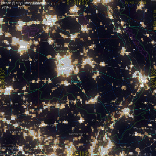
Analysis of Heeze night lights 2016
Square area 10x10 km:
 1.4%
1.4%90-99
2.1%80-89
1.12%70-79
0.98%60-69
5.88%50-59
1.96%40-49
2.52%30-39
4.2%20-29
9.24%10-19
28.01%0-9
42.58%Square area 50x50 km:
2.68%90-99
3.15%80-89
1.94%70-79
1.99%60-69
1.97%50-59
2.95%40-49
2.44%30-39
2.59%20-29
4.92%10-19
17.11%0-9
58.25%Clear (daylight) street map image can be seen on geolist.org.
Map coordinates:
51° 49' 10.3" North, 4° 52' 6" East
51° 22' 58.1" North, 5° 34' 17.2" East
50° 56' 30.7" North, 6° 16' 28.5" East
Some cities around Heeze sort by population:
• Valkenswaard
8.5 km =5.3 mi,  245°
245°
• Geldrop
4.4 km =2.7 mi,  349°
349°
• Cranendonck
8.8 km =5.5 mi,  172°
172°
• Tongelre
8.2 km =5.1 mi,  334°
334°
• Mierlo
7.2 km =4.5 mi,  27°
27°
• Waalre
8.8 km =5.5 mi,  272°
272°
• De Doornakkers
7.6 km =4.7 mi,  324°
324°
• Coevering
3.9 km =2.4 mi,  3°
3°
2754618 (p: 9,110)
Sources (retrieved 2019-11-25):
» Earth at Night: Flat Maps 2012, 2016