Gennep night lights from space
Night Light of Gennep (Limburg) from space (Netherlands) Src. Average luminocity for 10x10km area is 14.2913% and for 50x50km: 14.7712%.
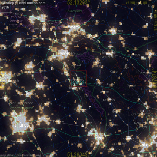
Analysis of Gennep night lights 2016
Square area 10x10 km:
 0.98%
0.98%90-99
1.26%80-89
1.4%70-79
1.96%60-69
1.12%50-59
2.66%40-49
1.96%30-39
2.1%20-29
1.26%10-19
24.51%0-9
60.78%Square area 50x50 km:
1.54%90-99
2.04%80-89
1.49%70-79
1.47%60-69
2.24%50-59
2.25%40-49
2.04%30-39
2.16%20-29
4.36%10-19
12.7%0-9
67.71%Clear (daylight) street map image can be seen on geolist.org.
Map coordinates:
52° 7' 55.3" North, 5° 16' 13.8" East
51° 41' 54" North, 5° 58' 25" East
51° 15' 37.5" North, 6° 40' 36.3" East
Some cities around Gennep sort by population:
• Kleve, DE
15.1 km =9.4 mi,  48°
48°
• Goch, DE
13 km =8.1 mi,  99°
99°
• Groesbeek
9.1 km =5.7 mi,  343°
343°
• Boxmeer
6 km =3.7 mi,  197°
197°
• Hatert
15.5 km =9.6 mi,  320°
320°
• Weeze, DE
17.4 km =10.8 mi,  117°
117°
• Kranenburg, DE
9.9 km =6.2 mi,  17°
17°
• Hengstdal
16.2 km =10.1 mi, 337°
2755584 (p: 16,642)
Sources (retrieved 2019-11-25):
» Earth at Night: Flat Maps 2012, 2016