Delft night lights from space
Night Light of Delft (South Holland) from space (Netherlands) Src. Average luminocity for 10x10km area is 92.2336% and for 50x50km: 54.4453%.
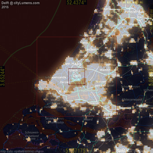
Analysis of Delft night lights 2016
Square area 10x10 km:
 53.28%
90-99
20.83%80-89
5.43%70-79
8.21%60-69
11.11%50-59
1.14%40-49
0%30-39
0%20-29
0%10-19
0%0-9
0%Square area 50x50 km:
22.55%90-99
14.14%80-89
3.36%70-79
3.81%60-69
5%50-59
3.82%40-49
3.92%30-39
5.79%20-29
8.35%10-19
6.89%0-9
22.36%Clear (daylight) street map image can be seen on geolist.org.
Map coordinates:
52° 26' 14.6" North, 3° 39' 8.8" East
52° 0' 24" North, 4° 21' 20" East
51° 34' 18.3" North, 5° 3' 31.3" East
Some cities around Delft sort by population:
• The Hague
8.7 km =5.4 mi,  333°
333°
• Rijswijk
3.9 km =2.4 mi, 327°
• Voorburg
7.5 km =4.7 mi,  2°
2°
• Ypenburg
3.9 km =2.4 mi,  14°
14°
• Berkel en Rodenrijs
8.6 km =5.3 mi,  100°
100°
• Pijnacker
5.3 km =3.3 mi,  74°
74°
• De Lier
8.1 km =5 mi,  244°
244°
• Overschie
9 km =5.6 mi,  146°
146°
2757345 (p: 95,060)
Sources (retrieved 2019-11-25):
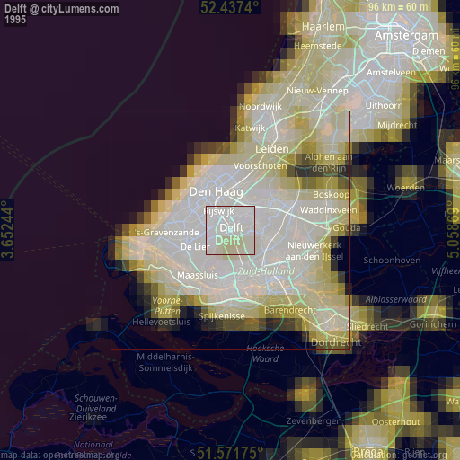
» NASA, Earths city lights 1995
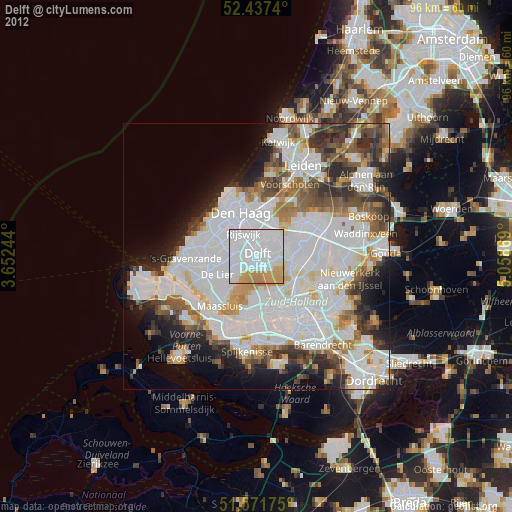
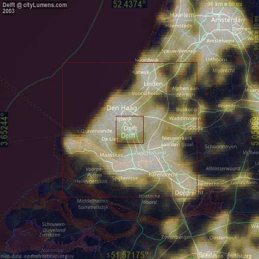
» NASA city lights 2003
» Earth at Night: Flat Maps 2012, 2016