Camminghaburen night lights from space
Night Light of Camminghaburen (Friesland) from space (Netherlands) Src. Average luminocity for 10x10km area is 26.7601% and for 50x50km: 3.2086%.
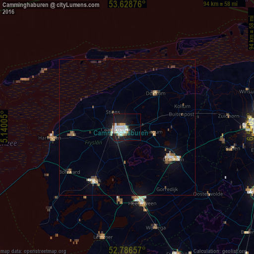
Analysis of Camminghaburen night lights 2016
Square area 10x10 km:
 7.07%
7.07%90-99
8.08%80-89
1.77%70-79
1.89%60-69
1.89%50-59
2.02%40-49
0.51%30-39
0.51%20-29
5.05%10-19
26.39%0-9
44.82%Square area 50x50 km:
0.41%90-99
0.59%80-89
0.29%70-79
0.26%60-69
0.42%50-59
0.38%40-49
0.38%30-39
0.36%20-29
0.47%10-19
2.57%0-9
93.88%Clear (daylight) street map image can be seen on geolist.org.
Map coordinates:
53° 37' 43.5" North, 5° 8' 24.2" East
53° 12' 35" North, 5° 50' 35.4" East
52° 47' 11.7" North, 6° 32' 46.7" East
Some cities around Camminghaburen sort by population:
• Leeuwarden
2.5 km =1.6 mi,  248°
248°
• Burgum
10 km =6.2 mi,  101°
101°
• Huizum
2.9 km =1.8 mi,  226°
226°
• Stiens
8.2 km =5.1 mi,  315°
315°
• Bilgaard
3.2 km =2 mi,  281°
281°
• Zuiderburen
4 km =2.5 mi,  180°
180°
• Damwâld
13.7 km =8.5 mi,  48°
48°
• Grou
12.8 km =8 mi, 181°
6324403 (p: 11,500)
Sources (retrieved 2019-11-25):
» Earth at Night: Flat Maps 2012, 2016