Bilgaard night lights from space
Night Light of Bilgaard (Friesland) from space (Netherlands) Src. Average luminocity for 10x10km area is 31.1679% and for 50x50km: 3.3604%.
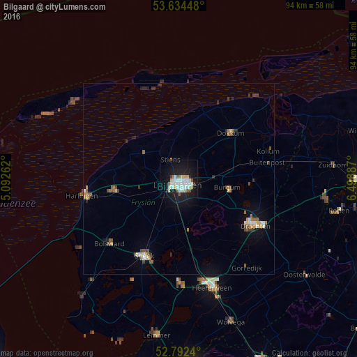
Analysis of Bilgaard night lights 2016
Square area 10x10 km:
 7.83%
7.83%90-99
8.96%80-89
2.65%70-79
1.89%60-69
2.4%50-59
2.02%40-49
1.01%30-39
1.14%20-29
5.3%10-19
32.2%0-9
34.6%Square area 50x50 km:
0.42%90-99
0.6%80-89
0.29%70-79
0.3%60-69
0.49%50-59
0.44%40-49
0.38%30-39
0.37%20-29
0.5%10-19
2.48%0-9
93.72%Clear (daylight) street map image can be seen on geolist.org.
Map coordinates:
53° 38' 4.1" North, 5° 5' 33.4" East
53° 12' 55.8" North, 5° 47' 44.7" East
52° 47' 32.6" North, 6° 29' 55.9" East
Some cities around Bilgaard sort by population:
• Leeuwarden
1.8 km =1.1 mi,  151°
151°
• Camminghaburen
3.2 km =2 mi,  101°
101°
• Burgum
13.2 km =8.2 mi, 101°
• Huizum
2.8 km =1.7 mi,  158°
158°
• Stiens
5.8 km =3.6 mi,  334°
334°
• Zuiderburen
5.6 km =3.5 mi, 146°
• Damwâld
15.8 km =9.8 mi,  58°
58°
• Grou
13.7 km =8.5 mi,  168°
168°
2758930 (p: 6,105)
Sources (retrieved 2019-11-25):
» Earth at Night: Flat Maps 2012, 2016