Burgum night lights from space
Night Light of Burgum (Friesland) from space (Netherlands) Src. Average luminocity for 10x10km area is 2.1338% and for 50x50km: 3.3213%.
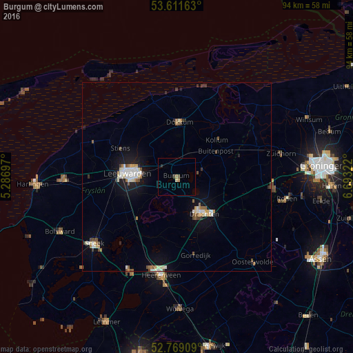
Analysis of Burgum night lights 2016
Square area 10x10 km:
 0%
0%90-99
0%80-89
0.51%70-79
0.51%60-69
0.51%50-59
0%40-49
1.01%30-39
0%20-29
0.51%10-19
0%0-9
96.97%Square area 50x50 km:
0.46%90-99
0.7%80-89
0.3%70-79
0.29%60-69
0.39%50-59
0.37%40-49
0.39%30-39
0.29%20-29
0.39%10-19
2.6%0-9
93.82%Clear (daylight) street map image can be seen on geolist.org.
Map coordinates:
53° 36' 41.9" North, 5° 17' 13.1" East
53° 11' 32.7" North, 5° 59' 24.3" East
52° 46' 8.7" North, 6° 41' 35.6" East
Some cities around Burgum sort by population:
• Drachten
11.5 km =7.1 mi,  140°
140°
• Camminghaburen
10 km =6.2 mi,  281°
281°
• Huizum
11.9 km =7.4 mi,  269°
269°
• De Drait
11.8 km =7.3 mi,  153°
153°
• Zuiderburen
10 km =6.2 mi,  257°
257°
• Damwâld
10.9 km =6.8 mi,  2°
2°
• Surhuisterveen
12 km =7.5 mi,  94°
94°
• De Westereen
7.8 km =4.8 mi,  23°
23°
2759103 (p: 9,720)
Sources (retrieved 2019-11-25):
» Earth at Night: Flat Maps 2012, 2016