Beek night lights from space
Night Light of Beek (North Brabant) from space (Netherlands) Src. Average luminocity for 10x10km area is 31.607% and for 50x50km: 22.9445%.
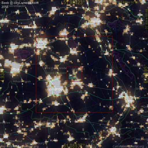
Analysis of Beek night lights 2016
Square area 10x10 km:
 2.14%
2.14%90-99
2.67%80-89
2.81%70-79
2.67%60-69
7.09%50-59
8.16%40-49
4.95%30-39
3.88%20-29
19.39%10-19
31.42%0-9
14.84%Square area 50x50 km:
3.62%90-99
4.3%80-89
2.1%70-79
2.51%60-69
2.77%50-59
2.92%40-49
2.49%30-39
3.07%20-29
6.11%10-19
21.12%0-9
49.01%Clear (daylight) street map image can be seen on geolist.org.
Map coordinates:
51° 57' 51.2" North, 4° 55' 50.5" East
51° 31' 44" North, 5° 38' 1.8" East
51° 5' 21.7" North, 6° 20' 13" East
Some cities around Beek sort by population:
• Helmond
5.6 km =3.5 mi,  160°
160°
• Veghel
11.4 km =7.1 mi,  328°
328°
• Nuenen
8.6 km =5.3 mi,  220°
220°
• Gemert
4.9 km =3 mi,  52°
52°
• Mierlo
9.9 km =6.2 mi,  185°
185°
• Boekel
8.8 km =5.5 mi,  18°
18°
• Vaartbroek
10.9 km =6.8 mi,  239°
239°
• Aarle-Rixtel
2.2 km =1.4 mi,  171°
171°
2759349 (p: 5,185)
Sources (retrieved 2019-11-25):
» Earth at Night: Flat Maps 2012, 2016