Veghel night lights from space
Night Light of Veghel (North Brabant) from space (Netherlands) Src. Average luminocity for 10x10km area is 31.4492% and for 50x50km: 25.732%.

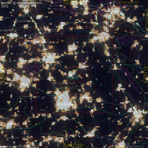
Analysis of Veghel night lights 2016
Square area 10x10 km:
 3.88%
3.88%90-99
6.82%80-89
1.6%70-79
4.41%60-69
3.88%50-59
3.21%40-49
1.87%30-39
2.41%20-29
4.95%10-19
56.82%0-9
10.16%Square area 50x50 km:
4.22%90-99
4.87%80-89
2.35%70-79
2.78%60-69
3.08%50-59
3.25%40-49
2.58%30-39
3.5%20-29
7.84%10-19
24.33%0-9
41.21%Clear (daylight) street map image can be seen on geolist.org.
Map coordinates:
52° 3' 4.2" North, 4° 50' 43.8" East
51° 37' 0" North, 5° 32' 55" East
51° 10' 40.7" North, 6° 15' 6.3" East
Some cities around Veghel sort by population:
• Uden
6.9 km =4.3 mi,  44°
44°
• Schijndel
8.1 km =5 mi,  274°
274°
• Sint-Oedenrode
8.2 km =5.1 mi,  228°
228°
• Gemert
11.9 km =7.4 mi,  124°
124°
• Heeswijk-Dinther
6.3 km =3.9 mi,  306°
306°
• Nistelrode
9.8 km =6.1 mi,  5°
5°
• Boekel
8.9 km =5.5 mi,  99°
99°
• Beek
11.4 km =7.1 mi,  148°
148°
2745726 (p: 25,352)
Sources (retrieved 2019-11-25):
» Earth at Night: Flat Maps 2012, 2016