Vom night lights from space
Night Light of Vom (Plateau) from space (Nigeria) Src. Average luminocity for 10x10km area is 1.9026% and for 50x50km: 4.4932%.
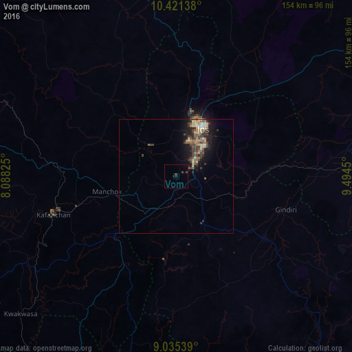
Analysis of Vom night lights 2016
Square area 10x10 km:
100  0%
0%
90-99 0%
80-89 0%
70-79 0%
60-69 0%
50-59 0%
40-49 1.08%
30-39 1.52%
20-29 0.43%
10-19 1.3%
0-9 95.67%
0%90-99
0%80-89
0%70-79
0%60-69
0%50-59
0%40-49
1.08%30-39
1.52%20-29
0.43%10-19
1.3%0-9
95.67%Square area 50x50 km:
100 0.02%
90-99 0.48%
80-89 0.86%
70-79 0.49%
60-69 0.73%
50-59 0.93%
40-49 1.01%
30-39 1.36%
20-29 0.94%
10-19 3.49%
0-9 89.69%
0.02%90-99
0.48%80-89
0.86%70-79
0.49%60-69
0.73%50-59
0.93%40-49
1.01%30-39
1.36%20-29
0.94%10-19
3.49%0-9
89.69%Clear (daylight) street map image can be seen on geolist.org.
Map coordinates:
10° 25' 17" North, 8° 5' 17.7" East
9° 43' 44.8" North, 8° 47' 29" East
9° 2' 7.4" North, 9° 29' 40.2" East
Some cities around Vom sort by population:
• Jos
24.8 km =15.4 mi,  26°
26°
• Lere
76.8 km =47.7 mi,  341°
341°
• Kafanchan
57.1 km =35.5 mi,  253°
253°
• Kagoro
46 km =28.6 mi, 252°
• Bukuru
10.7 km =6.6 mi,  47°
47°
• Lere
60.2 km =37.4 mi,  91°
91°
• Bokkos
52.7 km =32.7 mi,  154°
154°
• Panyam
58.6 km =36.4 mi,  127°
127°
2319407 (p: 12,000)
Sources (retrieved 2019-11-25):
» Earth at Night: Flat Maps 2012, 2016