Lere night lights from space
Night Light of Lere (Bauchi) from space (Nigeria) Src. Average luminocity for 10x10km area is 0% and for 50x50km: 0%.
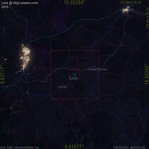
Analysis of Lere night lights 2016
Square area 10x10 km:
100  0%
0%
90-99 0%
80-89 0%
70-79 0%
60-69 0%
50-59 0%
40-49 0%
30-39 0%
20-29 0%
10-19 0%
0-9 100%
0%90-99
0%80-89
0%70-79
0%60-69
0%50-59
0%40-49
0%30-39
0%20-29
0%10-19
0%0-9
100%Square area 50x50 km:
100 0%
90-99 0%
80-89 0%
70-79 0%
60-69 0%
50-59 0%
40-49 0%
30-39 0%
20-29 0%
10-19 0%
0-9 100%
0%90-99
0%80-89
0%70-79
0%60-69
0%50-59
0%40-49
0%30-39
0%20-29
0%10-19
0%0-9
100%Clear (daylight) street map image can be seen on geolist.org.
Map coordinates:
10° 24' 10.2" North, 8° 38' 13.8" East
9° 42' 37.9" North, 9° 20' 25" East
9° 1' 0.4" North, 10° 2' 36.3" East
Some cities around Lere sort by population:
• Jos
54.8 km =34.1 mi,  296°
296°
• Pankshin
44.1 km =27.4 mi,  166°
166°
• Bukuru
53 km =32.9 mi,  280°
280°
• Amper
55.9 km =34.7 mi,  134°
134°
• Panyam
36.4 km =22.6 mi,  202°
202°
• Dass
37.6 km =23.4 mi,  30°
30°
• Bununu
41.9 km =26 mi,  62°
62°
• Boi
24.3 km =15.1 mi, 133°
2332080 (p: 14,620)
Sources (retrieved 2019-11-25):
» Earth at Night: Flat Maps 2012, 2016